Q-CTRL has demonstrated a quantum gravity navigation system capable of maintaining nautical-mile-level positioning aboard a moving vessel without using GNSS anywhere in the navigation measurement chain, marking an important step toward practical navigation in GPS-denied maritime environments.
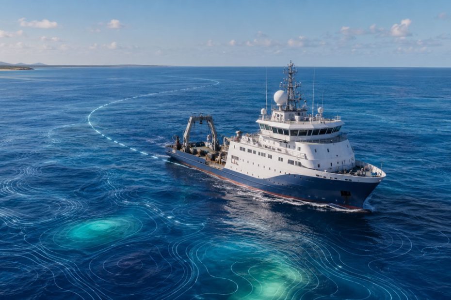
The Australian quantum technology company conducted the trials in the Coral Sea off Australia’s east coast using a mobile quantum gravimeter installed aboard a 29-meter surface vessel. According to the technical results published on August 26, 2026, the system used local gravity measurements to correct an inertial navigation solution over an 83 km maritime trajectory.
Q-CTRL says its system maintained positioning accuracy at approximately one nautical mile during the mission, more than 10 times better than navigation-grade GNSS backup performance used as a comparison in the company’s testing.
GPS-Free Gravity Navigation
The technology is part of Q-CTRL’s Ironstone Opal quantum navigation platform.
Rather than receiving positioning signals from satellites, GravNav measures small variations in Earth’s gravitational field. These gravity anomalies form geographic patterns that can be compared with existing gravity maps to estimate a vessel’s location.
The principle is similar to terrain matching, except the system is effectively navigating using invisible variations in gravity rather than mountains, coastlines or radio beacons.
This makes the technique fundamentally different from GNSS. It does not require an external navigation signal to be transmitted to the vessel and therefore cannot be disrupted by conventional radio-frequency GNSS jamming.
Q-CTRL combines those gravity measurements with an inertial navigation system. The gravimeter does not replace the INS. Instead, gravity map matching periodically constrains the position error that would otherwise continue accumulating as an inertial system drifts.
That distinction is important. High-quality inertial systems can navigate independently for significant periods, but their positioning error grows with time. A passive geophysical reference can potentially prevent that error from becoming unbounded.
83 km Maritime Trial
The published experiment used a hybrid sensor that combined an atomic quantum sensor with a classical accelerometer for bias stabilization, while a separate navigation-grade inertial measurement unit provided the inertial navigation solution.
The equipment was tested in both gimbaled and strapdown configurations during comparable routes.
For the navigation experiment, researchers excluded GNSS from the measurement chain and used the locally measured gravity signal together with a satellite-derived gravity anomaly map to correct the inertial trajectory over 83 km.
The result was bounded positioning at approximately nautical-mile accuracy rather than the continuously increasing error associated with an unaided INS.
That is arguably more significant than the headline accuracy figure itself.
One nautical mile is nowhere near the centimeter or meter-level positioning associated with modern GNSS. But the purpose of this system is different. It is intended to provide an independent position reference when satellite navigation is unavailable, unreliable or deliberately manipulated.
Strapdown Quantum Gravimeter
One of the most technically interesting elements of the trial was how little specialized infrastructure the quantum sensor required.
Quantum gravimeters have traditionally been associated with highly controlled measurement environments because atomic sensors are extremely sensitive not only to gravity, but also to vibration, acceleration, orientation and environmental disturbances.
A ship is almost the opposite of an ideal laboratory.
Q-CTRL says its software-ruggedized sensor operated from an uncontrolled passenger cabin without dedicated environmental stabilization, continuous recalibration or specialized motion compensation infrastructure.
The research team also found comparable performance between the gimbaled and strapdown configurations. That matters because eliminating a precision stabilized platform could substantially reduce the size, mechanical complexity and integration requirements of future operational systems.
Q-CTRL attributes much of this capability to software that filters motion and environmental noise while stabilizing the quantum measurement.
Sea State 4 Testing
The same quantum gravimeter was also evaluated as a marine surveying instrument.
In GNSS-referenced surveying tests, the sensor operated on coastal routes in conditions reaching Sea State 4. The researchers reported milligal-level agreement with existing gravity maps and sub-milligal repeatability and stability.
The system resolved gravity anomalies at an along-track scale of approximately 300 meters, about 50 times finer than the half-power wavelength of the satellite gravity map used in the study.
A separate 56-hour stationary experiment showed that atomic referencing reduced long-term drift by roughly 70 times compared with the classical sensor channel alone.
These results suggest that the technology could eventually have applications beyond navigation, including higher-resolution marine gravity surveying and geophysical mapping.
From MagNav to GravNav
Ironstone Opal was already being developed around another form of geophysical navigation called magnetic navigation, or MagNav.
MagNav compares measurements of Earth’s magnetic field against magnetic anomaly maps. Q-CTRL previously demonstrated the technique in ground and airborne trials.
In 2025 flight testing, the company reported positioning improvements of more than 100 times relative to a conventional GPS-independent navigation alternative, including results down to meter-scale positioning over flights extending hundreds of kilometers.
Gravity provides a complementary reference.
For maritime operations in particular, gravity mapping is attractive because large-scale marine gravity datasets already exist and gravitational anomalies do not depend on visibility, sunlight or the reception of radio signals.
Ironstone Opal is therefore evolving toward a multi-modal architecture in which magnetic or gravity measurements can be fused with existing inertial sensors depending on the operating environment.
Why the Trial Matters
The biggest achievement is not that Q-CTRL has produced a replacement for GPS. It has not.
A one-nautical-mile position uncertainty would be unsuitable for many precision navigation tasks that GNSS handles routinely.
The more important development is that Q-CTRL appears to have demonstrated a practical mechanism for stopping inertial navigation error from growing indefinitely without relying on another external radio-frequency navigation system.
That changes the role quantum navigation could play.
Instead of trying to reproduce GPS everywhere with a completely independent sensor, systems such as Ironstone Opal could become another layer in a resilient navigation architecture combining INS, GNSS, magnetic maps, gravity maps, vision, terrain matching and other signals of opportunity.
The strapdown result may ultimately be just as consequential as the navigation accuracy. Quantum sensors will have limited operational value if they require laboratory-style stabilization systems or frequent intervention by specialists. Demonstrating an atomic gravimeter in an ordinary ship cabin, under real vessel motion, moves the discussion closer to deployability rather than laboratory performance.
There are still important limitations.
The technical manuscript is currently an arXiv preprint rather than a peer-reviewed publication, and the demonstration covered an 83 km trajectory rather than the much longer missions expected from naval or commercial vessels. Navigation performance will also depend on gravity map resolution and on how distinctive the local gravity field is.
Scaling the hardware, reducing cost, proving reliability over much longer missions and validating performance across different oceans will therefore matter more than another laboratory sensitivity record.
But the experiment addresses exactly the issue that has held many alternative navigation technologies back: whether the sensor can remain useful after leaving a controlled research environment.
On that measure, Q-CTRL’s maritime demonstration is a meaningful result.
Quantum Navigation Demand
Interest in alternative positioning technologies has accelerated as GNSS jamming and spoofing have become operational problems for aviation, shipping and defense users.
Because gravity-based navigation is passive, an adversary cannot simply overpower its positioning signal with a stronger radio transmitter. A vessel measures a physical property of the Earth beneath it and compares the observation against a map.
That does not make an entire navigation system invulnerable. Maps, inertial sensors, computers and estimation algorithms can still introduce errors or become targets themselves.
But it removes one particularly important attack surface: dependence on a distant radio signal arriving from space.
Q-CTRL is already working with organizations including DARPA, the U.S. Defense Innovation Unit, the Australian Department of Defence, the UK Royal Navy and other AUKUS partners on quantum sensing and computing programs.
About Q-CTRL
Q-CTRL is an Australian quantum technology company founded in Sydney in 2017 by quantum physicist Michael J. Biercuk.
The company develops quantum control software, quantum computing infrastructure and quantum sensing systems, with Ironstone Opal serving as its navigation platform for GPS-denied air, land and maritime applications.
As of 2026, Q-CTRL reports approximately 220 employees, $133 million in capital raised and six global offices in Sydney, Los Angeles, San Francisco, Huntsville, Berlin and Oxford. Its investor group includes Airbus Ventures, Lockheed Martin Ventures, In-Q-Tel, Salesforce Ventures, Main Sequence Ventures and several other technology investment firms.
The company was founded on November 22, 2017, and has expanded from quantum control software into hardware and software systems for quantum sensing and navigation.