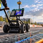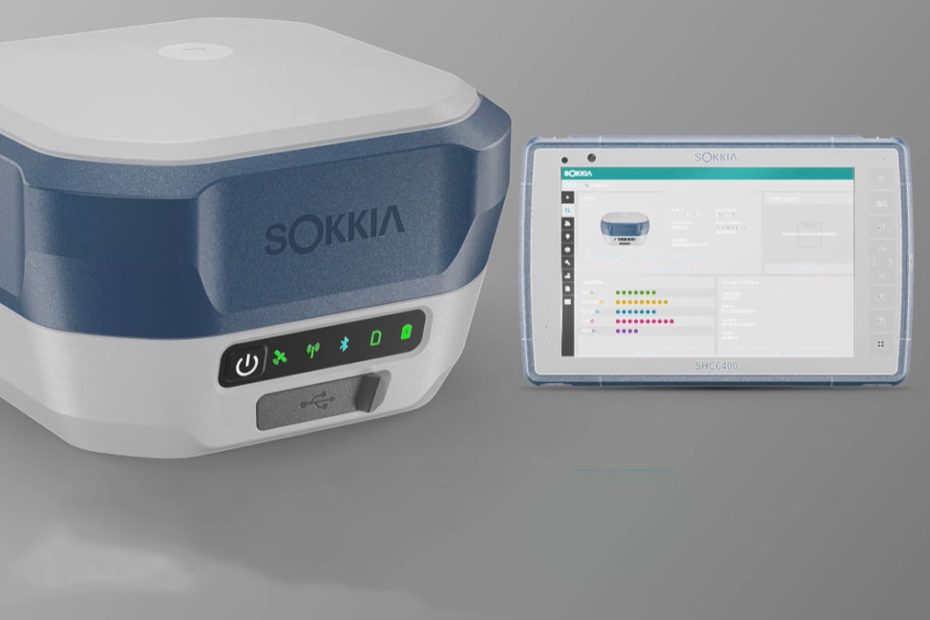
Sokkia, part of Japan’s Topcon Group, has expanded its surveying and geospatial equipment portfolio with six new instruments covering GNSS positioning, mobile 3D laser scanning and conventional optical surveying. The lineup includes the GCX5 and GRX7 GNSS receivers, SRS1 and SRS2 handheld scanners, and iM-60 and iM-120 manual total stations.
Showcased at INTERGEO 2026 in Munich, Germany, the new equipment reflects Sokkia’s broader effort to connect field measurements with digital mapping, engineering and construction workflows. The expansion also introduces more flexible reality capture options for surveyors working on infrastructure, buildings, utilities and complex terrain.
Sokkia GCX5 and GRX7 GNSS Receivers
The GCX5 and GRX7 are designed for real-time positioning in topographic surveying, construction layout, corridor mapping and infrastructure projects. Both receivers support Real-Time Kinematic (RTK) positioning through Topcon’s Topnet Live correction service.
One of their principal features is tilt compensation of up to 60 degrees, allowing surveyors to measure points without keeping the surveying pole perfectly vertical. This can improve productivity when collecting data near walls, fences, road edges and other obstacles where a conventional vertical setup is difficult.
The receivers also incorporate anti-jamming and anti-spoofing capabilities intended to improve positioning reliability in challenging GNSS environments. Sokkia targets applications where satellite reception may be affected by trees, buildings or surrounding terrain.
However, the announced 60-degree tilt capability should not be interpreted as a guarantee of survey accuracy under every condition. Actual positioning performance still depends on satellite geometry, signal quality, correction availability and the receiver’s ability to maintain a reliable solution.
Sokkia has not provided complete publicly available performance specifications for the two new receivers, including detailed RTK accuracy figures, supported frequency configurations and battery endurance. These details will be important when comparing the GCX5 and GRX7 with established professional GNSS systems.
Sokkia SRS1 and SRS2 SLAM Scanners
The new Shared Reality portfolio marks a significant expansion of Sokkia’s mobile mapping capabilities. Both SRS1 and SRS2 use laser scanning technology to collect three-dimensional point clouds while an operator moves through the surveyed environment.
Sokkia SRS1
The SRS1 is a professional mobile SLAM scanner designed for high-density 3D data collection. It supports handheld, backpack, vehicle-mounted and unmanned aircraft configurations, making it suitable for building surveys, urban mapping, transportation infrastructure and forestry applications.
According to Sokkia’s technical specifications, the SRS1 offers:
- Scanning speed of up to 640,000 points per second.
- Maximum advertised scanning range of 120 meters (394 feet).
- Absolute accuracy better than 3 cm and relative accuracy better than 1 cm.
- Weight of 2.2 kg (4.85 pounds), including the base, battery and RTK module.
- Approximately two hours of operation per battery.
- IP64 protection against dust and water ingress.
The scanner uses a 905 nm Class 1 laser and incorporates visual SLAM cameras, panoramic imaging and GNSS/RTK capabilities. Its specified detection range varies with target reflectivity, including 40 meters at 10% reflectivity and 70 meters at 80% reflectivity.
Sokkia SRS2
The lighter SRS2 is intended for portable mapping and site documentation, particularly where GNSS positioning or recognizable environmental features are limited.
It uses localization-fusion SLAM technology, combining available positioning inputs to calculate the scanner’s trajectory as the operator moves.
The SRS2 provides a scanning rate of 200,000 points per second, weighs approximately 1.3 kg (2.87 pounds), and offers absolute accuracy better than 3 cm and relative accuracy better than 2 cm under the manufacturer’s specified conditions. Its protection rating is IP64, with approximately two hours of battery operation.
Both scanners support several positioning and mapping methods, including RTK-SLAM and post-processed approaches. Their output options include colorized LAS point clouds and JPG panoramic images.
The collected data can be processed using MAGNET Flow and MAGNET Bridge, supporting subsequent integration into CAD and Building Information Modeling (BIM) workflows.
Sokkia iM-60 and iM-120 Total Stations
Alongside its GNSS and laser scanning equipment, Sokkia has introduced the iM-60 and iM-120 manual total station series.
The instruments target conventional survey operations, including control surveys, construction staking, layout measurements and as-built documentation.
The iM-60 series provides reflectorless distance measurement up to 500 meters (1,640 feet), with a stated distance accuracy of 2 mm + 2 ppm. Its electronic distance measurement system can complete a measurement in approximately 0.9 seconds under specified conditions.
Other features include IP66 protection, a 50,000-point internal memory, Bluetooth connectivity and up to 14 hours of battery operation. The instruments are designed to operate in temperatures ranging from -20°C to +60°C (-4°F to +140°F).
The iM-120 offers longer measurement ranges and additional productivity features.
Depending on the configuration, its technical specs:
- Reflectorless measurement up to 1,000 meters (3,280 feet).
- Prism measurement up to 6,000 meters (19,685 feet).
- Angular accuracy options of 1, 2, 3 or 5 arcseconds, depending on model and market.
- Internal storage for 99,999 points.
- Battery operation up to 28 hours in Eco mode.
- IP66 protection, Bluetooth connectivity and USB storage support.
The iM-120 also incorporates a guide light and dedicated trigger key intended to simplify field measurements and construction layout operations.
A More Connected Surveying Workflow
The most important development in Sokkia’s latest product expansion is the combination of conventional surveying instruments with mobile reality capture technology.
GNSS receivers remain essential for establishing georeferenced survey points over large areas, while total stations provide precise optical measurements where direct satellite positioning is unsuitable or insufficient. Mobile SLAM scanners add another dimension by rapidly documenting entire surfaces and complex structures rather than measuring individual points.
For engineering and construction companies, combining these methods could reduce repeated site visits and improve the availability of spatial information throughout a project.
The SRS1 is particularly interesting because its multiple mounting configurations allow the same scanning system to serve different operational requirements. A survey team could potentially use handheld scanning for building interiors and vehicle-based mapping for longer infrastructure corridors.
However, mobile SLAM scanning should not be treated as a direct replacement for high-precision static laser scanning or conventional survey control. SLAM trajectories can accumulate drift, particularly in long corridors or repetitive environments. Accurate control points, suitable processing procedures and independent quality checks remain essential.
Another consideration is the distinction between sensor accuracy and the final accuracy of a georeferenced point cloud. The performance of the complete mapping workflow depends on sensor calibration, trajectory estimation, ground control and processing quality.
From a technical perspective, Sokkia’s strongest move is therefore its emphasis on interoperability rather than any single hardware specification. The ability to combine GNSS observations, total station measurements and point clouds within compatible software workflows could deliver greater practical value than isolated improvements in instrument performance.
Pricing, regional availability and detailed field comparisons will ultimately determine how competitive the new systems are against established alternatives from Leica Geosystems, Trimble and other geospatial equipment manufacturers.
About Sokkia
Sokkia is a Japanese manufacturer of precision surveying and measurement instruments founded on April 16, 1920, in Tokyo under the original name Sokkisha. The business began with 13 founders and developed into an international supplier of optical surveying equipment, GNSS technology and digital measurement systems.
The company introduced its SET3 electronic total station in 1985 and adopted the Sokkia corporate name in 1992. In 2008, it became part of Topcon Corporation, founded in 1932.
In 2026, Sokkia marks 106 years since its foundation. Its parent, Topcon Group, operates through approximately 70 group companies across 30 countries and regions, with overseas markets accounting for about 80% of group sales. These international figures refer to Topcon Group as a whole, rather than Sokkia alone.