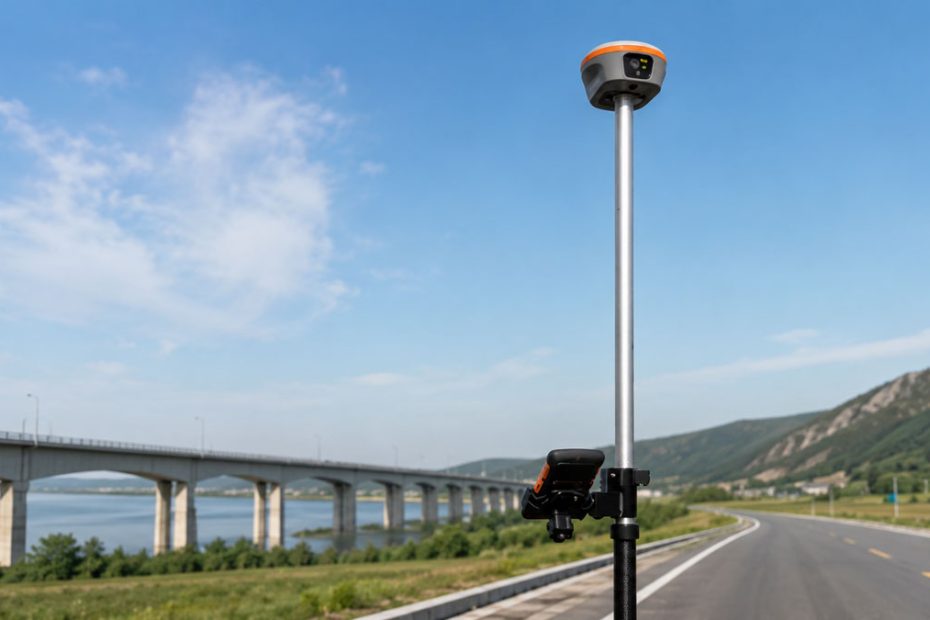
CHC Navigation has introduced PointX, a new high-precision positioning infrastructure designed to remove one of the persistent limitations of real-time GNSS workflows: dependence on a single correction delivery method.
The platform brings together CHCNAV’s PointNet network RTK service and PointSky satellite-based correction service, allowing compatible receivers and positioning terminals to use internet-delivered NRTK corrections where connectivity is available and satellite-delivered PPP corrections where it is not.
Rather than introducing another standalone correction network, CHCNAV is effectively building a common positioning layer intended to follow users between connected and remote operating environments.
The company officially announced PointX on July 31, 2026.
PointX Combines NRTK and PPP
The two components of PointX solve different positioning problems.
PointNet is CHCNAV’s network RTK service. Compatible GNSS devices receive real-time corrections over cellular or internet connections using the NTRIP protocol. This is the familiar model used across many surveying and machine-control applications, particularly in areas with established reference station infrastructure.
PointSky takes a different approach. Corrections are transmitted through geostationary satellites using L-band communications and PPP technology. A compatible receiver can therefore obtain high-accuracy corrections without depending on a nearby base station, radio link, cellular network or internet connection.
The practical significance is not simply that CHCNAV now offers both technologies. Network RTK and satellite PPP services have coexisted in the positioning industry for years.
What changes with PointX is the attempt to treat them as parts of the same positioning infrastructure rather than separate products selected for separate projects.
PointNet Uses 10,000+ Stations
For locations with reliable connectivity, PointNet remains the faster and more conventional route to centimeter-level positioning.
CHCNAV says the service is supported by more than 10,000 GNSS reference stations. More than 99.5% of those stations provide full-constellation, full-frequency GNSS observations.
The company also claims service availability of at least 99.99%, supported by redundant cloud infrastructure, continuous system monitoring and a microservice architecture designed to serve large numbers of simultaneous users.
That scale matters because correction services are increasingly becoming infrastructure rather than accessories to GNSS receivers.
A surveyor may only see an NTRIP connection and a fixed solution on the controller, but behind that connection sits an increasingly complex combination of reference stations, GNSS data processing, communications networks, cloud services and correction-generation algorithms.
By operating that infrastructure itself, CHCNAV gains greater control over the complete positioning workflow.
PointSky Targets Remote Sites
PointSky addresses the locations where the NRTK model becomes difficult or impossible to maintain.
That includes offshore surveying, pipelines, power transmission corridors, remote construction projects, mining operations, agricultural fields and other sites where cellular connectivity can disappear completely.
Instead of transmitting corrections through the internet, PointSky broadcasts them through L-band satellites.
CHCNAV says users do not need a local GNSS reference station, radio communication system or NTRIP connection. Full positioning accuracy is typically reached within one to five minutes, while convergence can be reduced to less than one minute in selected enhanced service areas.
The convergence figure is particularly important.
Historically, one of the clearest operational differences between RTK and PPP has been initialization time. Network RTK can normally produce centimeter-level fixed positioning very quickly when reference infrastructure and communications are available. PPP provides much wider coverage but traditionally requires a longer convergence period.
Reducing that delay makes satellite correction services much more practical for workflows where operators frequently stop, restart or move between work areas.
Connectivity Becomes Less Critical
PointX is therefore less about choosing which positioning technology is superior and more about reducing the consequences when communications conditions change.
Consider a surveying team working along a long infrastructure corridor.
Near populated areas, the receiver may have excellent cellular connectivity and access PointNet through NTRIP. Several kilometers later, mobile coverage may deteriorate or disappear.
Traditionally, that transition can require another correction service, a local base station or a change in the field workflow.
A platform that can provide both network and satellite corrections from the same ecosystem makes that boundary less important.
The same concept applies to precision agriculture and machine control. Large farms can include areas with excellent cellular service and others where network coverage is unreliable. Autonomous equipment presents an even stricter requirement because positioning interruptions that may merely inconvenience a human surveyor can interrupt an automated operation entirely.
CHCNAV Builds a Positioning Ecosystem
The more interesting aspect of PointX is what it suggests about CHCNAV’s broader strategy.
GNSS manufacturers have traditionally competed heavily on receiver specifications: satellite tracking, channel counts, IMUs, initialization performance, radios and field software.
Those differences still matter, but high-precision positioning is increasingly moving toward an integrated service model in which the receiver is only one component.
Correction networks, cloud infrastructure, GNSS algorithms, communications links, field software and hardware are becoming parts of one positioning stack.
PointX gives CHCNAV another layer of that stack.
The company already develops GNSS receivers, positioning modules, machine-control systems, agricultural autosteering systems, LiDAR equipment and autonomous navigation technologies. Adding a unified correction infrastructure means CHCNAV can increasingly control the path from GNSS observations and correction generation to the final position calculated by the user’s hardware.
There is, however, an important limitation.
PointX currently remains closely connected to the CHCNAV hardware ecosystem. PointNet and PointSky availability is specified for compatible CHCNAV receivers, modules and positioning terminals, and service availability, convergence time and performance can vary by region, device and subscription.
For existing CHCNAV users, that integration can be an advantage. For mixed fleets using positioning equipment from several manufacturers, interoperability will be one of the areas worth watching as the platform develops.
Why PointX Matters
The most important feature of PointX may ultimately be something users do not want to think about at all: how GNSS corrections reach the receiver.
High-precision positioning is most useful when correction delivery becomes nearly invisible to the operator.
Network RTK should be used when network infrastructure provides the best solution. Satellite corrections should take over where terrestrial connectivity becomes impractical. The field crew should not need to redesign an entire project because the communication environment changes.
PointX moves toward that model.
It also reflects a wider transition across the positioning industry. As surveying, agriculture, construction and robotics become increasingly automated, correction services will need to behave more like continuously available infrastructure and less like individual GNSS subscriptions.
CHCNAV’s decision to combine terrestrial NRTK and satellite PPP services under one platform is therefore more significant than simply adding another correction option.
It is an attempt to make the communication path secondary to the positioning result.
If CHCNAV can expand PointX coverage while maintaining predictable convergence, accuracy and service continuity across both delivery methods, the platform could become an important competitive advantage in markets where positioning systems increasingly need to work beyond the reach of conventional cellular networks.
About CHC Navigation
CHC Navigation, also known as CHCNAV, was founded in Shanghai in 2003 and develops positioning, navigation and mapping technologies for surveying, construction, precision agriculture, machine control, mapping and autonomous applications.
The company now employs more than 2,200 people and operates through partners and regional organizations in more than 140 countries. CHCNAV also reports more than 1,000 R&D engineers across the organization.
CHC Navigation is publicly listed in China under stock code 300627.SZ.
For fiscal 2025, the company reported revenue of CNY 3.70 billion, up 13.78% year over year, while net profit attributable to shareholders increased 17.49% to CNY 685 million. International revenue grew substantially faster, rising 35.16% to CNY 1.27 billion.
CHCNAV invested CNY 558 million in research and development during 2025, equivalent to 15.08% of annual revenue.