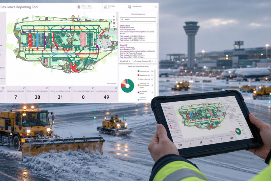
Heathrow Airport has officially launched a new enterprise geospatial platform designed to centralize infrastructure data, simplify operational workflows, and improve decision making across one of the world’s most complex transportation hubs. The new system, called Heathrow Explorer, represents another major step in the airport’s long term digital transformation strategy, replacing fragmented legacy mapping tools with a unified GIS environment accessible from desktops and mobile devices.
Enterprise GIS for Airport Infrastructure
The platform consolidates information for more than 500,000 physical assets into a single digital environment. Instead of relying on disconnected databases, paper maps, or department specific software, airport personnel can now access a live operational view of infrastructure through interactive maps and dashboards.
The deployment initially supports approximately 3,000 employees working across engineering, airport operations, emergency services, property management, retail, and airline support functions. By integrating nearly 300 individual data layers, Heathrow Explorer provides immediate access to critical technical information regardless of where staff are working.
The solution was developed using Esri’s Geographic Information System technology, allowing the airport to standardize data management while improving cybersecurity, mobile accessibility, and collaboration between operational teams.
Digital Engineering Improves Maintenance
One of the platform’s most significant advantages is its support for Heathrow’s digital engineering initiative. Engineers can instantly retrieve maintenance records, infrastructure details, inspection history, and asset locations directly from smartphones or tablets while working in the field.
Eliminating the need to return to offices or consult multiple software platforms reduces maintenance delays and enables faster planning of inspections, repairs, and future infrastructure upgrades. The centralized approach also helps improve data consistency across departments that previously maintained separate asset records.
Real Time Winter Operations
The first operational application introduced on Heathrow Explorer focuses on winter resilience. Airfield teams responsible for snow removal and de icing operations now receive live situational updates directly on handheld devices rather than relying on printed airfield maps.
Managers can identify the nearest available snow clearance teams, dispatch resources more efficiently, and monitor progress in real time. Faster coordination is expected to reduce runway downtime during severe winter weather and minimize disruption to flight schedules.
Mobile Tools Support Emergency Response
Emergency response capabilities have also been strengthened through dedicated applications for Heathrow’s fire service. Crews now have instant access to detailed maps showing hydrant locations, water system availability, and the airport’s extensive fire protection network, which includes approximately 72 miles of fire mains.
Having live infrastructure information available on mobile devices improves operational awareness during emergency incidents while supporting training exercises and long term response planning.
Collaboration Beyond Airport Operations
The new GIS platform is not limited to Heathrow employees. Major contractors participating in the airport’s infrastructure modernization program have also been granted access, allowing engineering partners to coordinate projects using the same authoritative data.
In addition, Heathrow has introduced specialized geospatial applications for managing community related programs, including property repair and compensation initiatives associated with aircraft noise and wake turbulence impacts.
Analysis
What makes Heathrow Explorer particularly important is not simply its mapping capability but the way it transforms geographic information into an operational decision platform. Modern airports generate enormous volumes of engineering, safety, environmental, and operational data. When those datasets remain isolated, efficiency suffers and response times increase. Heathrow’s approach demonstrates how enterprise GIS is evolving from a visualization tool into critical operational infrastructure that supports maintenance, emergency response, construction management, and daily airport operations from a single source of truth.
As transportation hubs continue adopting digital twins, AI assisted asset management, and predictive maintenance, platforms like Heathrow Explorer are likely to become standard components of next generation airport infrastructure worldwide.
About Heathrow Airport
Heathrow Airport is the busiest airport in the United Kingdom and one of the world’s largest international aviation hubs. The airport operates two runways and four passenger terminals while serving more than 200 destinations across over 80 countries. In recent years Heathrow has accelerated investment in digital infrastructure, automation, sustainability initiatives, and asset management technologies to improve operational resilience and passenger experience across one of Europe’s most complex airport environments.