Real-Time Kinematic positioning has transformed from a specialized surveying tool into a fundamental infrastructure layer for autonomous systems, precision agriculture, and location-based services. Traditional RTK networks, operated by government agencies and commercial providers, have delivered centimeter-level accuracy for years. However, these centralized systems come with limitations that decentralized alternatives are now addressing through blockchain technology and distributed infrastructure models.
Why Centimeter-Level Positioning Requires RTK Correction Data
Standard GPS provides accuracy within 5 to 10 meters under optimal conditions. This level of precision works for navigation and general location services, but fails to meet requirements for autonomous vehicles, drone delivery systems, and precision agriculture equipment. The limitation stems from signal interference caused by atmospheric conditions, satellite clock errors, and multipath effects where signals bounce off buildings or terrain before reaching the receiver.
RTK technology solves this problem by establishing a fixed base station at a known location. The base station calculates the difference between its known position and the position reported by GPS satellites, then broadcasts these correction values to nearby receivers. When a mobile receiver applies these corrections, positioning accuracy improves to 1-2 centimeters horizontally and 2-3 centimeters vertically.
The challenge lies in infrastructure. Each base station costs between $15,000 and $50,000 to deploy and requires ongoing maintenance, data connectivity, and operational oversight. Traditional RTK networks typically charge subscription fees ranging from $50 to $200 per month per rover, creating barriers for smaller operators and limiting geographic coverage to economically viable regions.
How Decentralized RTK Networks Change the Infrastructure Model
Decentralized RTK platforms shift from the centralized operator model to a distributed network where individual station owners contribute infrastructure in exchange for token rewards. This approach resembles other decentralized physical infrastructure networks that have emerged for wireless connectivity and environmental sensing.
Station owners purchase or build GNSS receivers equipped with high-precision antennas and processing units. These stations continuously broadcast correction data to the network, which validates the data quality and distributes it to users. Instead of monthly subscriptions to a single provider, users typically purchase access through cryptocurrency payments or token economics built into the platform.
The economic model relies on reducing deployment costs and distributing operational expenses across many participants. Consumer-grade RTK base stations now cost between $300 and $2,000, making individual ownership feasible. Station operators earn tokens based on uptime, data quality, and geographic coverage contribution, creating financial incentives for network expansion into underserved areas.
RTKDirect: Multi-Network Access Through a Unified Platform
RTKDirect operates as an aggregator rather than building its own base station network. The platform connects to multiple existing RTK networks, including both traditional providers and decentralized networks, then offers unified access through a single interface and payment system.
Users access RTKDirect through NTRIP client software compatible with standard RTK receivers. The platform handles authentication, network selection, and payment processing in the background. This approach removes the complexity of managing multiple network subscriptions and provides fallback options when primary networks experience outages.
The payment system accepts cryptocurrency alongside traditional payment methods. RTKDirect’s pricing structure varies by region and network quality, with rates generally lower than traditional RTK subscriptions. The platform also offers pay-as-you-go options rather than requiring long-term contracts.
For station owners, RTKDirect provides a distribution channel to monetize their infrastructure without building their own user base. The platform handles billing, customer support, and technical integration while sharing revenue with network operators. This creates a marketplace where independent RTK networks can compete on coverage and price rather than brand recognition or sales infrastructure.
The technical architecture supports multiple concurrent connections, allowing users to switch between networks based on coverage or service quality. RTKDirect’s system monitors connection status and can automatically failover to alternative networks when the primary source becomes unavailable.
GEODNET: Blockchain-Based Compensation for Station Operators
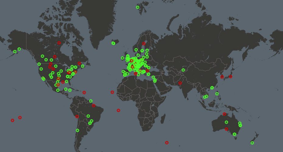
GEODNET has built one of the largest decentralized RTK networks through a token reward system tied to the Solana blockchain. Station operators receive GEOD tokens based on their contribution to network coverage and data quality. The project has deployed thousands of stations globally since launching in 2022.
The network uses a proof-of-position consensus mechanism where stations must demonstrate they are providing accurate correction data from verified locations. GEODNET’s validation system cross-references multiple stations in overlapping coverage areas to detect anomalies and prevent operators from spoofing locations or broadcasting invalid data.
Station hardware comes in two forms. GEODNET sells proprietary reference stations designed specifically for their network, priced around $500 to $1,000 depending on antenna specifications. The company also provides software that allows users to convert existing RTK equipment into GEODNET stations, expanding compatibility with professional-grade receivers that operators may already own.
Token rewards follow a dynamic algorithm that accounts for geographic scarcity and network gaps. Stations in areas with limited existing coverage earn higher rewards than those in saturated markets. This mechanism encourages network expansion into rural regions and developing countries where traditional RTK infrastructure has been economically unviable.
Users access GEODNET correction data through standard NTRIP protocols. The service costs approximately $20 to $50 monthly, with payments accepted in GEOD tokens or cryptocurrency. The platform also offers an API for developers building applications that require precise positioning data.
Data quality on GEODNET varies by station density and operator maintenance practices. In well-covered urban areas, users typically achieve the same 1-2 centimeter accuracy as commercial RTK networks. Rural areas with sparse station coverage may see degraded performance, though the network continues expanding to address these gaps.
The blockchain foundation provides transparent accounting of station uptime and reward distribution. All network activity gets recorded on-chain, allowing station operators to verify their compensation and users to assess coverage quality before subscribing.
Onocoy: Data Quality Verification and Scientific-Grade Standards
Onocoy differentiates itself through rigorous data validation and scientific partnerships. The network focuses on data integrity over rapid expansion, implementing multi-layer verification systems that check correction data against geodetic reference networks and cross-validate between stations.
Station operators on Onocoy must meet higher technical standards than typical decentralized networks require. The platform specifies antenna models, mounting requirements, and environmental considerations to maintain consistency across the network. Stations undergo a qualification period where their data gets compared against established reference networks before they can earn full rewards.
The verification system uses algorithms developed in partnership with geodetic research institutions. These algorithms detect subtle errors in correction data that might not affect basic RTK positioning but could compromise applications requiring scientific-grade accuracy. Onocoy’s approach appeals to users in surveying, geoscience research, and infrastructure monitoring where data traceability and accuracy certification matter.
Token economics on Onocoy reward data quality alongside uptime and coverage. Stations that maintain low error rates and high consistency earn premium rewards compared to those with acceptable but less reliable performance. This creates financial incentives for operators to invest in better antennas, stable mounting systems, and reliable power and connectivity infrastructure.
The network operates on Ethereum and later added support for Polygon to reduce transaction costs. Station operators receive ONO tokens that can be traded on cryptocurrency exchanges or used to purchase services within the ecosystem. Users pay for access through token-based subscriptions or traditional payment methods converted to tokens by the platform.
Onocoy has developed partnerships with agricultural technology companies and autonomous vehicle developers. These commercial relationships provide steady demand for the network’s correction data and validate the quality standards that Onocoy has implemented.
Coverage remains more limited than larger decentralized networks because of the higher barriers to station deployment. However, in areas where Onocoy stations operate, data quality metrics consistently match or exceed commercial RTK network standards. The platform publishes performance statistics and station quality scores, giving users transparency into coverage reliability.
Technical Differences Between Projects and Traditional RTK Networks
Traditional RTK networks typically operate using permanent reference station networks designed and maintained by professional surveyors. These systems achieve exceptional reliability through redundant stations, professional-grade equipment, and rigorous calibration procedures. However, they also require substantial capital investment and ongoing operational costs that get passed to subscribers.
Decentralized networks reduce deployment costs but introduce variables in station quality and maintenance. A traditional network might use $30,000 reference stations with survey-grade antennas and climate-controlled enclosures. Decentralized stations often use $500 to $2,000 equipment with consumer or prosumer-grade components.
This cost difference affects data consistency. Traditional networks typically maintain station coordinates accurate to millimeters through regular surveys and monument stability monitoring. Decentralized stations may experience coordinate drift if antennas get bumped or mounting structures settle, though validation algorithms attempt to detect and correct for these issues.
Uptime represents another distinction. Commercial RTK providers typically guarantee 99% or higher availability with support staff monitoring network health around the clock. Decentralized networks depend on individual operators maintaining their equipment, leading to more variable uptime across different coverage areas.
Data latency matters for real-time applications. Traditional networks often operate dedicated communication infrastructure with guaranteed low latency. Decentralized networks rely on station operators’ internet connections, which may introduce variable delays depending on connection quality and network congestion.
The geographic coverage model differs substantially. Traditional networks concentrate stations in economically attractive markets where subscription revenue justifies deployment costs. Decentralized networks can achieve coverage in remote areas if even a single operator finds the token rewards worthwhile relative to their costs.
Real-World Applications Driving Demand for Decentralized RTK
Precision agriculture represents the largest current market for RTK positioning. Farmers use RTK-guided tractors and sprayers to reduce overlap in field operations, cutting fuel consumption and input costs while improving yield uniformity. Traditional RTK subscriptions cost thousands of dollars annually per farm, making decentralized alternatives with lower subscription fees attractive for operations with tight margins.
Autonomous vehicles require lane-level positioning accuracy that standard GPS cannot provide. While many autonomous systems use multiple sensor types including LiDAR and cameras, RTK correction data provides a stable reference that helps fuse sensor inputs and maintain accuracy across varying environmental conditions. Decentralized RTK networks offer broader coverage than traditional networks in suburban and rural areas where autonomous delivery and logistics applications are expanding.
Drone operations increasingly require precision positioning for mapping, inspection, and delivery applications. Survey-grade mapping demands centimeter accuracy to produce useful elevation models and volumetric calculations. Decentralized RTK networks allow drone operators to access correction data without the overhead of establishing their own base stations or paying for traditional network subscriptions in every region where they operate.
Construction and surveying traditionally relied on proprietary RTK networks from equipment manufacturers or regional service providers. Smaller contractors and independent surveyors now use decentralized networks to access the same positioning accuracy at lower subscription costs. However, professional applications often still prefer traditional networks due to reliability guarantees and professional support.
Geospatial data collection for mapping, asset management, and environmental monitoring benefits from widespread RTK availability. Organizations collecting location data across large geographic areas face challenges when traditional RTK coverage is inconsistent. Decentralized networks fill coverage gaps and provide more uniform data quality across diverse regions.
Economic Models and Token Sustainability in Decentralized RTK
Token economics present both opportunities and risks for decentralized RTK networks. Station operators invest capital in hardware with the expectation that token rewards will provide return on investment within a reasonable timeframe. Network sustainability depends on balancing token issuance against actual demand from paying users.
Early-stage networks often issue generous token rewards to incentivize rapid network expansion. This creates a bootstrapping period where station deployment outpaces organic user demand. The model works if user adoption accelerates before token inflation erodes operator returns to unsustainable levels.
GEODNET addresses this through dynamic reward adjustments based on geographic density and network growth targets. As station density increases in an area, per-station rewards decrease to maintain economic efficiency. This prevents over-deployment in profitable markets while maintaining incentives for expansion into underserved regions.
Onocoy’s approach ties rewards to data quality and scientific validation, creating a quality floor that limits how many stations can profitably operate. This naturally constrains network expansion to operators willing to meet higher standards, potentially creating more sustainable economics at the cost of slower coverage growth.
RTKDirect sidesteps token economics entirely by operating as a traditional service business with cryptocurrency payment options. This model has more predictable economics but lacks the decentralized ownership and incentive alignment that blockchain-based networks offer.
Long-term sustainability requires real revenue from end users to exceed or replace token inflation as the primary compensation mechanism for station operators. Networks must either grow user bases substantially or transition to lower reward rates as coverage matures.
Technical Challenges in Maintaining Data Quality Across Distributed Networks
Validation of correction data quality presents ongoing challenges for decentralized RTK networks. Traditional networks employ professional staff who monitor station performance, investigate anomalies, and perform regular maintenance. Decentralized networks must automate these processes or accept higher variance in data quality.
Cross-station validation helps detect outliers by comparing correction data from nearby stations. When multiple stations in an area produce consistent corrections, the network gains confidence in data quality. When a station reports corrections that differ significantly from its neighbors, automated systems can flag it for investigation or temporarily remove it from the network.
However, this approach works best in areas with dense station coverage where multiple reference points exist. In rural areas with isolated stations, validation becomes more difficult. Networks must balance between accepting potentially lower quality data from the only available source and maintaining strict quality standards that might leave coverage gaps.
Antenna placement and monument stability affect correction data quality in ways that may not be immediately apparent. A station mounted on a building roof may experience subtle position changes as the structure expands and contracts with temperature. An antenna near reflective surfaces may receive multipath interference that degrades signal quality. These issues require either rigorous station setup guidelines that operators may not follow consistently or sophisticated algorithms that detect and compensate for various error sources.
Coordinate reference frame maintenance adds another layer of complexity. Professional RTK networks carefully manage transformations between global and local coordinate systems, updating transformations as tectonic plates shift or reference frame definitions change. Decentralized networks must automate these updates or risk providing correction data that drifts out of alignment with standard coordinate systems over time.
Network latency and data delivery reliability vary with station operators’ internet infrastructure. A station with unstable connectivity may provide high-quality corrections intermittently, creating challenges for users who need consistent real-time data. Networks typically implement buffering and prediction algorithms to smooth over brief outages, but longer connectivity losses degrade service quality.
Regulatory Considerations and Future Infrastructure Development
Spectrum allocation and broadcast regulations differ across countries, affecting how RTK networks can operate legally. Traditional RTK networks typically operate under telecommunications licenses or exemptions for low-power scientific equipment. Decentralized networks with thousands of individual operators face challenges ensuring each station complies with local regulations.
Some countries restrict or regulate precise positioning services for national security reasons. China, for example, requires mapping and surveying activities to use government-approved coordinate systems and may prohibit unauthorized high-precision GNSS services. Decentralized networks must navigate these regulations or accept that certain markets remain inaccessible.
Data privacy and security concerns arise when positioning infrastructure operates through distributed systems. Users transmitting their location to request correction data potentially expose their movements to network operators. While correction data itself doesn’t require revealing user location, some authentication and billing systems may create privacy implications that regulations like GDPR address in different ways than traditional centralized services.
Professional liability questions emerge when autonomous systems or safety-critical applications rely on decentralized positioning infrastructure. If a decentralized RTK network provides incorrect correction data that contributes to an accident, liability may be difficult to assign across distributed station operators and network protocols. This uncertainty may slow adoption in applications where positioning errors could cause harm.
Future development likely involves hybrid models that combine decentralized station networks with centralized quality control and professional operation of critical infrastructure. Some regions might maintain government or commercial core networks while using decentralized stations to extend coverage. This approach could provide reliability where needed while capturing the cost and coverage benefits of distributed infrastructure.
Integration with emerging positioning technologies may expand the role of decentralized networks. Low Earth orbit satellite constellations, improved multi-frequency GNSS signals, and advances in precise point positioning could reduce dependence on ground-based correction infrastructure. Alternatively, these technologies might complement RTK networks by providing fallback positioning or enabling new applications that require even higher accuracy than current RTK systems deliver.
The competition between traditional and decentralized RTK infrastructure will likely continue shaping both business models. Traditional providers may lower prices or expand coverage to compete with decentralized alternatives, while decentralized networks mature their quality control and reliability to meet professional standards. Users ultimately benefit from increased options and the pressure on both models to improve service while reducing costs.


