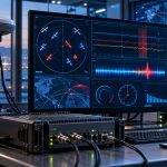
NATO has moved its experimental GANDALF GNSS interference detection system from controlled testing into real maritime and airborne operations, marking another step toward giving military forces the ability to identify not only when satellite navigation is being disrupted, but potentially where that disruption is coming from.
The NATO Communications and Information Agency, or NCIA, conducted the latest GANDALF-4 trials in Finland from July 6 through July 9, 2026, working with the Finnish Border Guard and Finnish Defence Forces.
The system was installed aboard the Finnish Border Guard offshore patrol vessel Turva and an H215 Super Puma helicopter, allowing engineers to evaluate its performance under substantially more complex conditions than those found in a stationary laboratory.
GANDALF Tracks GNSS Interference
GANDALF stands for Ground-based Asset designed and built by NCIA for Direction and Location Finding.
Developed by specialists at NCIA’s Joint Intelligence, Surveillance and Reconnaissance Centre, the experimental sensor is intended to detect, classify and locate sources of interference affecting Global Navigation Satellite System signals.
That distinction is important.
Conventional GNSS monitoring may indicate that GPS or another satellite navigation service has become unreliable. GANDALF is being developed to provide significantly more intelligence about the interference itself, including its characteristics and potentially the direction or location of the transmitter responsible.
The system is specifically aimed at threats such as GNSS jamming and spoofing. Jamming overwhelms the extremely weak signals arriving from navigation satellites, while spoofing attempts to deceive the receiver with false navigation signals that can produce an incorrect position.
For military forces, commercial shipping and aviation, the second scenario can be especially difficult because the navigation system may continue operating while providing misleading information.
NCIA says the latest Finnish trials produced additional operational data that will be used to validate previous findings and continue refining the system.
Testing Moves to Ships and Aircraft
The July campaign represents an important transition in the GANDALF development program.
NCIA and the NATO Support and Procurement Agency previously tested GANDALF-4 in specialized controlled facilities. In 2025, the technology also underwent flight testing aboard a Finnish Defence Forces NH90 helicopter.
Putting the equipment on Turva and an H215 adds a much less predictable operational environment.
A moving vessel introduces changing headings, antenna geometry, reflections from the sea surface and other sources of electromagnetic complexity. An airborne platform adds another combination of speed, altitude, orientation and rapidly changing relationships between the sensor and a potential interference source.
Those conditions matter if NATO ultimately wants the technology to do more than provide an alarm when GPS stops working.
A useful operational system needs to help determine what type of interference is occurring and where it originates while the receiving platform itself is moving.
That is a substantially more difficult problem.
Anti-Jamming Antenna Tested
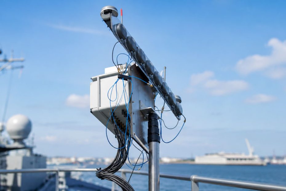
NCIA also used the Finnish campaign to evaluate its latest Controlled Reception Pattern Antenna technology.
CRPA systems use multiple antenna elements and signal-processing techniques to control the direction from which a GNSS receiver accepts signals. Interference arriving from a particular direction can potentially be suppressed while legitimate satellite signals remain available.
In practical terms, the two technologies address different sides of the same problem.
GANDALF is intended to improve situational awareness by detecting and locating interference. CRPA technology is intended to help the navigation receiver continue functioning despite that interference. NCIA is evaluating the technologies as complementary components of a more resilient navigation architecture.
GPS Jamming Becomes an Operational Problem
The significance of the project extends beyond the GANDALF hardware itself.
GNSS was originally treated primarily as a positioning technology. Modern military and civilian infrastructure has turned it into something much broader.
Satellite navigation signals support positioning, navigation and precise timing across aircraft, ships, drones, telecommunications networks and numerous automated systems. As dependence on GNSS has expanded, deliberate disruption of those signals has become increasingly consequential.
This changes the engineering priority.
The objective can no longer simply be to build a receiver with better positioning accuracy. Future navigation systems increasingly need to understand when GNSS data should not be trusted, survive interference where possible and provide operators with information about the electromagnetic threat surrounding them.
That makes interference detection a form of situational awareness rather than merely a navigation feature.
Why GANDALF Matters
The most interesting aspect of GANDALF is not that NATO has built another GPS jammer detector. Equipment capable of recognizing interference already exists in several forms.
The more important development is the attempt to combine detection, classification and geolocation into an operational sensor that can work from moving platforms.
Knowing that GPS has been jammed tells an operator there is a problem.
Knowing what type of signal is causing the disruption and approximately where the source is located creates an entirely different level of information.
That data could eventually be shared across aircraft, ships, unmanned systems and ground units, allowing multiple sensors to build a real-time picture of GNSS interference across a wider operating area.
There is also a broader technological trend behind the program. Navigation resilience is increasingly moving away from the idea of finding a single replacement for GPS. Instead, military and high-reliability systems are likely to combine protected GNSS reception, interference monitoring, inertial navigation, terrain or vision-based positioning, signals of opportunity and other positioning technologies.
In that architecture, a system such as GANDALF could become important not because it replaces GNSS, but because it tells the rest of the navigation system when GNSS can still be trusted.
That may ultimately be more valuable than another incremental improvement in positioning accuracy.
About NCIA
The NATO Communications and Information Agency is NATO’s principal provider of communications and information systems and one of the Alliance’s primary organizations for delivering digital, cyber and command-and-control capabilities. Its work spans secure communications, cybersecurity, satellite communications, surveillance, infrastructure, software and operational technology.
NCIA operates across approximately 30 NATO campuses, while its NATO Integrated Mission Services Centre alone has more than 300 employees, operates from 15 locations and generates more than €52 million in operating revenue.
The Agency is also investing heavily in future technologies. Its technology strategy covers six major technology themes, including quantum technologies, space, next-generation networks, cybersecurity and data exploitation, supported by 17 strategic initiatives. The NCI Academy trained 7,022 students in 2024, illustrating the scale of NCIA’s role across NATO’s technical ecosystem.