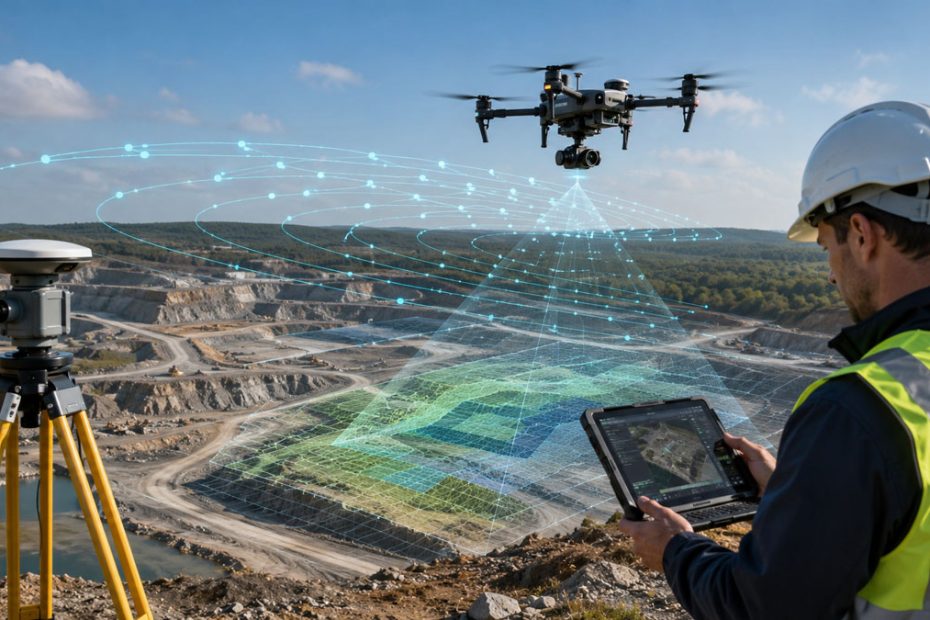
Klau Geomatics has introduced a significant workflow upgrade for professional drone mapping with the release of batch parallel processing in KlauPPK UAV Software Version 3.0, allowing several flights from the same survey project to be processed and delivered as one mission.
The update addresses a familiar problem in UAV surveying. A mapping job may represent a single project on the ground, but battery limitations, site dimensions, weather windows or operational restrictions frequently divide data collection into several individual flights. Each flight then creates its own GNSS observations, image folders and processing tasks.
KlauPPK 3.0 is designed to remove much of that administrative fragmentation without treating the underlying positioning data as though it came from one continuous flight.
KlauPPK Multi-Flight PPK Processing
The important distinction in the new workflow is that KlauPPK does not simply merge several flights before processing.
Each flight is processed independently through its own multi-pass PPK calculation, allowing the software to optimize the GNSS solution for that particular flight. Only after positioning has been calculated are the resulting camera coordinates, photographs and associated data organized into a combined mission.
That approach produces a single project output containing:
- One consolidated set of camera positions.
- One complete image list.
- One coordinated export for downstream processing.
For surveyors, this is a more meaningful improvement than simply adding a batch button. Individual flights can have different satellite geometry, base-station conditions, initialization behavior and GNSS quality. Maintaining independent processing helps preserve visibility into those differences while removing the repetitive project-management work surrounding them.
Parallel PPK Processing
KlauPPK 3.0 can process the individual flights in parallel and displays separate progress information for each dataset.
The workflow also checks whether suitable base-station observations are available for every flight. Where CORS data is being used, requests can cover the full time span of the combined mission rather than forcing the operator to handle correction data separately for every sortie.
That becomes increasingly useful as a project grows.
A survey requiring six battery flights, for example, is still one mapping job from the customer’s perspective. Traditionally, however, the processing workflow can behave more like six small jobs that must later be assembled manually.
Version 3.0 brings the software workflow closer to the way survey teams actually think about the project.
Duplicate Drone Images
Combining multiple image directories introduces another practical problem: duplicate filenames.
Many drone and camera systems use predictable or sequential naming conventions. Multiple flights can therefore produce photographs with identical filenames even though the images were captured at completely different locations and times.
KlauPPK can detect these conflicts and provides an option to correct duplicate filenames before the final dataset is created.
The software can also automatically collect photographs from multiple flight folders, reducing another manual preparation step before photogrammetric processing begins.
These may sound like relatively small improvements, but filename conflicts and incorrectly organized imagery can become expensive mistakes on large surveys. Automation at this stage is particularly valuable because it reduces the possibility of introducing errors after the GNSS processing itself has already been completed correctly.
PPK Quality Control by Flight
Klau Geomatics has retained individual quality monitoring within the consolidated workflow.
Solution quality is displayed using color-coded results for each flight, allowing operators to identify a weaker mission segment rather than seeing only a generalized result for the complete project.
That separation matters.
A multi-flight survey should be easier to manage as one project, but it should not become a black box. If one flight has poorer GNSS observations or inadequate base coverage, the operator needs to know which dataset requires attention.
KlauPPK’s approach effectively separates processing integrity from project organization: the flights remain individually evaluated from a positioning perspective while becoming unified from a delivery perspective.
One Dataset for Photogrammetry
After processing is complete, KlauPPK assembles the calculated camera positions and corresponding photographs into a common dataset that can be transferred into photogrammetry software.
KlauPPK supports image geotagging as well as CSV, TXT and KML exports, and its current software is designed to integrate with platforms including Agisoft Metashape and Pix4D. It also supports global and national coordinate systems, regional grids, geoids and site localization workflows.
The result is a cleaner transition between field acquisition, GNSS post-processing and photogrammetric reconstruction.
That is particularly relevant for high-volume UAV mapping, where the time spent moving, renaming, checking and matching files can become almost as important as the actual GNSS computation.
Why the KlauPPK 3.0 Update Matters
The most interesting part of this release is not that KlauPPK can process several flights simultaneously. Parallel computation by itself is largely a productivity feature.
The more important development is the shift toward mission-level processing rather than flight-level processing.
Professional drone mapping has outgrown workflows built around the assumption that one takeoff equals one project. Large construction sites, mines, corridors, agricultural properties and infrastructure surveys routinely require multiple flights, and the software layer needs to recognize that operational reality.
Klau Geomatics appears to have taken the right architectural approach here. Keeping the PPK solution independent for each flight preserves the ability to diagnose positioning quality, while consolidating the outputs eliminates unnecessary operator work.
It also reduces one of the less discussed risks in drone surveying: human error introduced between technically correct processing stages.
PPK accuracy receives considerable attention, but an accurate coordinate is of little value if the wrong photograph is associated with it, a flight folder is omitted, correction data covers the wrong time range or duplicate filenames create problems later in the workflow.
Version 3.0 therefore looks less like a new positioning algorithm and more like an improvement to the production environment surrounding positioning. For organizations processing large numbers of flights, that may ultimately deliver more practical value.
About Klau Geomatics
Klau Geomatics Pty Ltd is an Australian geospatial technology company based in South Nowra, New South Wales. The company was incorporated in 2008, initially working in surveying, mapping and exploration in remote areas of Australia. Its founder and director, Rob Klau, has approximately 30 years of international experience in surveying, geodesy, mapping and geodetic control.
KlauPPK has been delivering professional UAV positioning software since 2014, according to the company’s current product information. The platform supports multi-pass and forward/reverse GNSS processing, multi-constellation positioning, CORS integration, 3D lever-arm correction, coordinate and vertical datum transformations, photo geotagging and photogrammetry exports. Current UAV compatibility includes platforms from DJI as well as manufacturers such as Freefly, Anzu, Autel and Skydio.
The company’s technology portfolio has expanded beyond UAV PPK into surveying, mapping, sensor integration and edge-based geospatial processing, while KlauPPK remains one of its longest-running positioning products.