GeoCue is expanding its Canadian presence through a new distribution agreement with Candrone, giving surveying, mapping, forestry, mining, energy and public safety organizations across Canada local access to the company’s TrueView LiDAR systems and LP360 point cloud processing software.
Under the agreement, Candrone will sell and support GeoCue’s aerial, mobile and handheld LiDAR solutions while also providing customers with access to LP360, the software platform used to process, classify and convert captured LiDAR data into usable geospatial deliverables.
The partnership effectively gives GeoCue a Canadian sales, integration and support channel built around a company that already specializes in enterprise UAV systems and remote sensing.
TrueView LiDAR in Canada
Candrone has worked with commercial drone operators and enterprise customers in Canada since 2010, with applications spanning surveying, forestry, mining, energy, public safety and industrial remote sensing. The company is headquartered in Burnaby, British Columbia and positions itself as a systems integrator rather than simply a drone hardware reseller.
That distinction matters for LiDAR deployments.
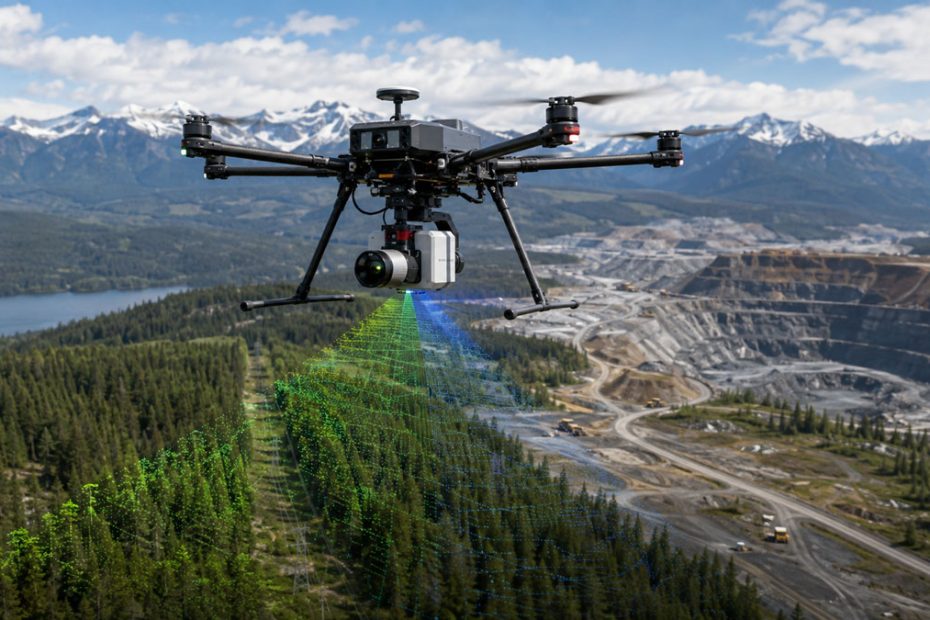
Professional airborne LiDAR systems typically involve substantially more than selecting a sensor and attaching it to a UAV. Aircraft compatibility, GNSS and INS configuration, trajectory processing, calibration, flight planning, point cloud classification and final deliverable production all affect whether a system produces survey-ready results.
GeoCue’s approach is built around controlling more of that workflow within one ecosystem.
TrueView systems combine LiDAR, positioning and imaging hardware, while LP360 handles much of the processing after collection. GeoCue also offers handheld and mobile mapping configurations, allowing the same general software environment to support datasets collected from several platforms.
LP360 Point Cloud Workflow
LP360 is particularly important to the partnership because GeoCue is not positioning TrueView as a standalone sensor product.
The software supports LiDAR and photogrammetric point cloud workflows that can extend from field processing through ground classification, terrain modeling, volumetric calculations and preparation of engineering or surveying deliverables.
GeoCue acquired QCoherent Software, the original developer of LP360, in 2009 and has since developed the platform internally. LP360 originally focused heavily on airborne LiDAR processing before expanding into drone, mobile and other point cloud workflows.
GeoCue also connects the platform with LP360 Cloud, an AWS-hosted environment used to organize projects, distribute deliverables and manage elements of the TrueView hardware ecosystem, including calibration files, firmware and licensing.
For Canadian operators, that means Candrone can potentially supply not only the data acquisition hardware but also the processing environment and technical support required to turn raw flight data into deliverables.
NDAA-Compliant LiDAR
Another notable element of the agreement is GeoCue’s emphasis on NDAA-compliant LiDAR equipment.
That issue has become increasingly relevant to North American government agencies, infrastructure contractors and organizations whose procurement rules restrict certain foreign-manufactured drone and imaging technologies.
GeoCue has been expanding its NDAA-focused TrueView lineup and continues to introduce aerial and handheld systems aimed at professional mapping applications.
Candrone therefore gains a LiDAR portfolio that can address customers for whom procurement compliance is becoming nearly as important as accuracy, range or point density.
Canadian LiDAR Market
The distribution agreement also fits a broader expansion strategy at GeoCue.
During 2026, the company has added or expanded distribution relationships across several markets, including the United States and Europe, as it builds a larger dealer network around the combination of TrueView hardware and LP360 software. Recent agreements have covered territories ranging from the southeastern United States to Germany, Austria, Switzerland, Greece, Cyprus and the Balkans.
Canada is a logical market for the same model.
The country has substantial demand for airborne mapping in forestry, mining, utilities, transportation corridors and large remote-area surveys. These are applications where LiDAR can have a strong advantage over conventional photogrammetry, particularly when vegetation penetration or accurate terrain models are required.
Local technical support can also become important when systems are being used hundreds or thousands of miles from the original equipment manufacturer.
What the Partnership Means
The most significant aspect of this agreement is not simply that another company can now sell GeoCue equipment in Canada.
LiDAR is increasingly becoming a workflow business.
Raw point density, range and scanner specifications still matter, but professional users ultimately care about how reliably they can move from a flight to a classified point cloud, terrain surface, contours, volumes or another usable engineering product.
That is where the TrueView and LP360 combination becomes strategically interesting.
GeoCue controls both major sides of the process: data acquisition and point cloud processing. Adding an experienced Canadian integrator gives the company another way to reduce one of the remaining pain points in professional drone LiDAR adoption, namely deployment and support after the hardware has been purchased.
There is also a competitive angle. Many LiDAR manufacturers can offer impressive sensor specifications. Fewer can provide a tightly integrated sensor, trajectory, processing, training and support environment through one supplier network.
If Candrone can provide strong local implementation support rather than functioning primarily as a reseller, the partnership could make GeoCue considerably more competitive with other enterprise LiDAR platforms in Canada.
About GeoCue
GeoCue was founded in 2003 and is headquartered in Madison, Alabama. The privately held company lists 11 to 50 employees and currently has more than 6,800 LinkedIn followers.
The company entered LiDAR processing software more deeply through its 2009 acquisition of QCoherent Software, developer of LP360. In 2014, GeoCue established a division focused on high-accuracy mapping with small unmanned aircraft systems.
Its current portfolio includes the TrueView aerial, mobile and handheld LiDAR product families, LP360 point cloud processing software and LP360 Cloud. GeoCue describes itself as the largest supplier of kinematic LiDAR processing tools in North America, with LP360 also used within organizations including the USGS, U.S. Army Corps of Engineers, USDA and U.S. Forest Service.
Candrone is based in Burnaby, British Columbia, operates with a listed company size of 11 to 50 employees, and has worked in the Canadian commercial drone market since approximately 2010.