Topcon Positioning Systems and Proceq, part of Screening Eagle Technologies, have announced a technology collaboration designed to connect ground penetrating radar (GPR) with high-precision GNSS positioning and digital mapping workflows. The partnership targets infrastructure surveying, construction and underground asset management across Europe, the Middle East and Africa (EMEA).
Announced on September 15, 2026, during INTERGEO in Munich, Germany, the agreement brings together Proceq’s subsurface scanning technology and Topcon’s positioning, correction services and geospatial data management software. The objective is to make underground survey information easier to locate accurately, analyze and integrate into broader digital infrastructure models.
The collaboration focuses on a longstanding challenge in construction and utility surveying: identifying what lies beneath the surface is only part of the task. Engineers also need reliable geographic coordinates to connect those findings with existing maps, engineering designs and asset databases.
Proceq GPR Meets Topcon GNSS
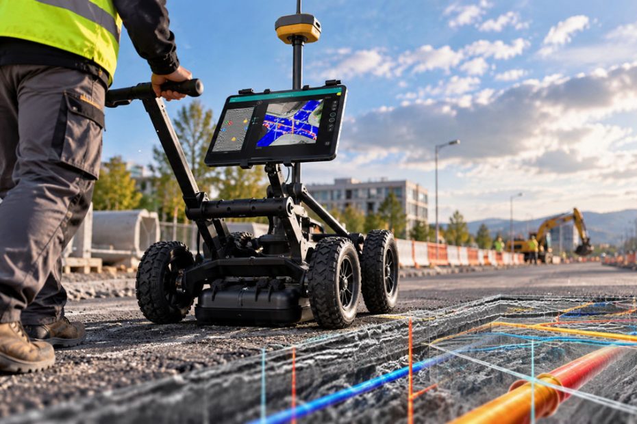
The integrated workflow combines Proceq’s GS8000 ground penetrating radar system with Topcon GNSS receivers, Topnet Live positioning correction services and Collage Web mass-data management software.
Ground penetrating radar transmits electromagnetic signals into the ground and analyzes their reflections to identify changes in subsurface materials. Depending on soil conditions, target characteristics and radar configuration, the technology can help detect buried pipelines, cables, underground voids and variations in pavement structure.
However, radar measurements alone do not automatically provide the precise geographic positioning required for professional infrastructure mapping.
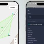
By connecting Proceq GPR equipment with Topcon GNSS technology, surveyors can associate detected underground features with spatial coordinates. Topnet Live provides positioning corrections, while Collage Web allows georeferenced information to be managed alongside other survey datasets.
According to the companies, the combined workflow is intended to reduce separate positioning operations and manual georeferencing. This could simplify the transfer of subsurface information into geographic information systems (GIS), building information modeling (BIM) environments and infrastructure asset management platforms.
Underground Utility Mapping
One of the most promising applications is underground utility detection, particularly in densely developed urban environments where accurate information about buried infrastructure is often incomplete.
Excavation projects frequently encounter discrepancies between existing utility maps and actual underground conditions. Older pipelines may have been installed without precise surveying, while subsequent repairs and infrastructure upgrades can leave records fragmented across different databases.
Combining GPR scanning with accurately positioned GNSS observations offers a more systematic approach to updating those records.
Survey teams could identify potential underground features, assign coordinates to their detected locations and incorporate the findings into digital site models. Such information could help engineers plan excavation routes, assess utility conflicts and prioritize additional investigations before construction begins.
The integration also has potential applications in road reconstruction, bridge inspections and tunnel maintenance. Radar measurements can reveal variations in subsurface layers or possible structural anomalies, while precise positioning makes it easier to revisit specific locations and compare survey results over time.
Importantly, GPR interpretation remains dependent on field conditions and operator expertise. GNSS integration improves the geographic referencing of radar data, but it does not eliminate uncertainty about the identity, depth or condition of detected objects.
Topnet Live and Collage Web Integration
Topcon’s contribution extends beyond satellite positioning hardware.
Its Topnet Live service delivers GNSS correction data that can support centimeter-level positioning under suitable conditions and with compatible equipment. Such precision is particularly valuable when survey measurements must be aligned with engineering coordinate systems or integrated into existing geospatial databases.
Collage Web provides another important component by supporting the organization, visualization and sharing of large geospatial datasets.
For infrastructure operators, the ability to combine above-ground survey measurements with underground radar information could improve the consistency of digital asset records.
A contractor working on a major road project, for example, might collect surface topography using GNSS or other surveying instruments while simultaneously investigating underground utilities with GPR. Bringing those datasets into connected workflows would reduce the need to manually reconcile independently collected information.
The companies have identified interoperability as a central goal, although they have not publicly specified every supported receiver configuration, data format or software licensing requirement.
Why the Partnership Matters
The most significant aspect of this collaboration is not the combination of two individual instruments. GNSS-assisted GPR surveying already exists, and professional subsurface mapping systems have supported georeferenced data collection for years.
The more important development is the effort to connect subsurface sensing directly with a broader geospatial data ecosystem.
Topcon has been expanding its portfolio of integrated surveying, reality capture and digital construction technologies. Adding Proceq’s specialized radar capabilities strengthens the subsurface component of that strategy without requiring Topcon to develop an entirely separate GPR product family.
For Proceq, the partnership provides a route into established GNSS surveying and construction workflows, potentially making its radar systems more attractive to customers already using Topcon equipment and software.
There is also a wider industry implication. Infrastructure owners increasingly require digital records that combine information about visible structures with reliable data on underground assets. The technical challenge is shifting from collecting individual measurements toward making information from different sensors usable within the same project environment.
This is where the Topcon and Proceq partnership could deliver measurable value.
Nevertheless, its commercial success will depend on practical implementation. Survey professionals will want to know whether the integration reduces field setup time, preserves coordinate accuracy across different environments and transfers interpreted radar information into engineering software without extensive manual processing.
Compatibility, software costs and data exchange capabilities may ultimately matter more to customers than the partnership announcement itself.
INTERGEO 2026 Presentation
The collaboration was introduced during INTERGEO 2026, held September 15 through 17 in Munich.
The exhibition provided an opportunity for both companies to present their combined technology to surveyors, geospatial specialists, construction contractors and infrastructure operators.
The announcement also formed part of Topcon’s broader INTERGEO 2026 focus on integrated geomatics workflows, including positioning, reality capture, monitoring and digital data management.
Neither company disclosed financial terms for the agreement. The announcements also did not establish a comprehensive commercial rollout schedule or pricing structure for the integrated offering.
The next important milestone will therefore be how the collaboration translates into commercially supported solutions and practical deployments across the EMEA region.
About Topcon Positioning Systems
Topcon Positioning Systems is a U.S.-headquartered precision technology company serving construction, geomatics and agricultural markets. Its headquarters are in Livermore, California, with European operations headquartered in Zoetermeer, Netherlands.
The company is part of Japan’s Topcon Corporation, founded in 1932, giving the parent organization 94 years of history in 2026. Its technology portfolio includes GNSS positioning, robotic total stations, 3D measurement systems, machine control, survey software and digital construction solutions.
Topcon’s Topnet Live network correction services and Collage Web platform support positioning and geospatial data workflows for professional users.
About Proceq and Screening Eagle Technologies
Proceq was founded in Zurich, Switzerland, on April 8, 1954, and has more than 72 years of experience in nondestructive testing technology as of 2026.
The company originally developed the Schmidt rebound hammer for concrete testing and later expanded into ultrasonic inspection, portable hardness testing and ground penetrating radar systems.
Proceq is now part of Screening Eagle Technologies, a Swiss-Singaporean company combining inspection sensors, software and digital infrastructure intelligence.
Its GPR portfolio includes the GS8000 subsurface mapping system and the GS9000 multichannel radar platform, introduced in 2024 with real-time 3D visualization capabilities. The company’s technologies serve construction inspection, utility mapping, structural assessment and infrastructure maintenance markets.
Source: www.topconpositioning.com