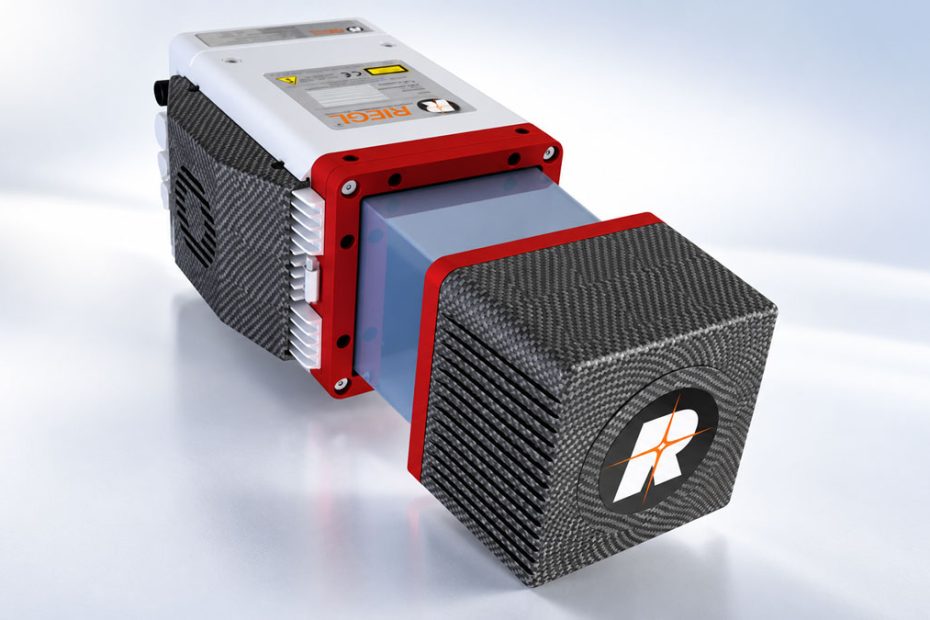
RIEGL has introduced the miniVUX-4UAV, a lightweight airborne LiDAR scanner designed for UAV-based surveying, topographic mapping, and high-resolution 3D data collection. The new sensor made its debut at INTERGEO 2026 in Munich, Germany, expanding the company’s portfolio of laser scanning equipment for professional drone applications.
The miniVUX-4UAV combines selectable laser pulse repetition rates of up to 400 kHz with multi-target detection, allowing surveyors to capture terrain and surface features in environments where vegetation, complex structures, and limited visibility can make conventional aerial mapping difficult.
The scanner is available as a standalone sensor or as part of an integrated mapping system with cameras and GNSS/IMU equipment for georeferenced point cloud generation.
RIEGL miniVUX-4UAV Specs
The miniVUX-4UAV offers four selectable laser pulse repetition rates: 100, 200, 300, and 400 kHz. Its maximum measurement rate reaches 200,000 points per second, depending on the scanning configuration.
The sensor supports a full 360-degree field of view, while its specified operating configuration within a 120-degree field of view provides up to 133,333 measurements per second. Maximum scan speed reaches 150 scans per second.
According to RIEGL, the scanner achieves 12 mm measurement accuracy and 8 mm precision. Its focused laser beam produces an elliptical footprint measuring approximately 125 × 50 mm at a distance of 100 m.
The main published specs:
- Laser pulse repetition rate: 100, 200, 300, or 400 kHz.
- Maximum measurement rate: 200,000 measurements per second.
- Field of view: 360 degrees, with a 120-degree operating configuration.
- Measurement rate within 120 degrees: up to 133,333 measurements per second.
- Maximum scan speed: 150 scans per second.
- Measurement accuracy: 12 mm.
- Measurement precision: 8 mm.
- Laser footprint at 100 m: 125 × 50 mm.
- Multi-target detection: up to five returns per laser pulse.
The stated accuracy and precision describe the scanner’s measurement performance rather than the absolute positioning accuracy of a completed georeferenced survey. Final point cloud accuracy also depends on GNSS/IMU performance, calibration, flight geometry, and processing.
Five-Return LiDAR for Forestry and Terrain Mapping
One of the miniVUX-4UAV’s key features is its ability to record up to five target echoes from a single laser pulse.
When scanning a forest, for example, a laser pulse may encounter the upper canopy, branches, understory vegetation, and ground surface at different distances. Recording multiple returns provides additional information for distinguishing vegetation layers and identifying terrain beneath partial canopy cover.
RIEGL combines this capability with echo signal digitization and online waveform processing to identify individual targets and calculate their distances.
The sensor is intended for several professional applications, including forestry inventory, archaeological surveys, cultural heritage documentation, power line and transportation corridor mapping, construction monitoring, and environmental surveys.
Its multi-return capability is particularly relevant to projects requiring both surface models and information about objects located at different elevations.
However, the ability to record five returns does not guarantee ground detection beneath dense vegetation. Actual ground-point density depends on canopy structure, flight altitude, scan angle, and survey configuration.
UAV Integration and GNSS/IMU Options
The miniVUX-4UAV weighs approximately 1.55 kg (3.4 lb) and features a compact aluminum housing designed for integration with multirotor, rotary-wing, and fixed-wing UAV platforms.
RIEGL offers the scanner as an independent LiDAR unit for custom payload configurations or as part of a complete mapping system incorporating cameras and positioning equipment.
The available RiLOC integration options:
- RiLOC-E25: A cost-efficient GNSS/IMU configuration intended for smaller-scale surveying applications.
- RiLOC-F: A higher-precision GNSS/IMU configuration designed for applications requiring more accurate LiDAR georeferencing.
- The integrated solutions combine GNSS positioning with inertial measurements to determine the scanner’s position and orientation during flight.
- This information is essential for converting individual laser measurements into geographically referenced 3D point clouds, particularly during drone maneuvers and changes in aircraft attitude.
Where the miniVUX-4UAV Fits
The most significant development in the miniVUX-4UAV is the combination of a focused laser beam, high scan speed, and multi-return processing in a lightweight airborne sensor.
For professional surveying, the value of a LiDAR system is determined by more than its maximum measurement rate. The ability to produce consistent point density, resolve small objects, and capture usable ground returns can be more important than generating a large number of measurements.
The miniVUX-4UAV’s 120-degree scanning configuration is particularly relevant here. Concentrating measurements within a defined field of view can help operators collect detailed data along flight corridors without allocating measurements to directions outside the required survey area.
Its 1.55 kg weight also makes the scanner suitable for integration into relatively compact professional UAV platforms, although the complete payload weight will depend on the selected positioning system, cameras, mounting hardware, and power supply.
For forestry and infrastructure surveying, the combination of five-return detection and waveform processing is arguably more useful than the headline measurement rate alone. These features can provide additional information about vegetation structure and partially obscured objects.
The distinction between the scanner’s 12 mm measurement accuracy and the final accuracy of a georeferenced point cloud is equally important. Surveyors should evaluate the complete LiDAR and GNSS/IMU configuration rather than treating the scanner’s ranging specifications as a guarantee of survey accuracy.
RIEGL has not provided pricing or independently verified field performance results in the published product information. These details will be important when comparing the miniVUX-4UAV with competing UAV LiDAR solutions.
About RIEGL
RIEGL is an Austrian manufacturer of laser measurement systems headquartered in Horn, approximately 85 km (53 miles) northwest of Vienna.
Founded in 1978, the company has more than 48 years of experience in laser scanning technology and develops equipment for airborne, terrestrial, mobile, industrial, and UAV-based applications.
The RIEGL Group employs more than 320 people worldwide. Its headquarters in Austria provides more than 74,000 square feet of workspace for research, development, manufacturing, sales, and administration, along with approximately 350,000 square feet of outdoor product testing facilities.
The company maintains its North American headquarters in Winter Garden, Florida, and operates through international offices and distribution partners serving markets across Europe, Asia, the Americas, Africa, and Australia.