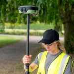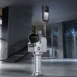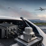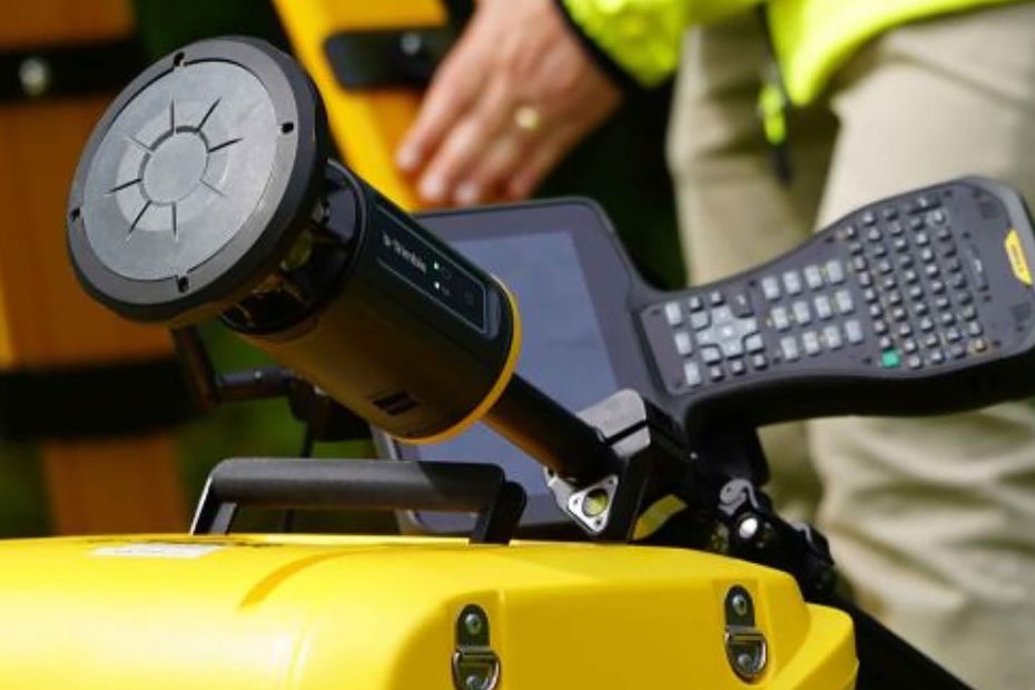
Trimble has launched the ST30 smart target, a new surveying device that combines a 360-degree prism, inertial measurement unit, GNSS receiver and automatic rod-height measurement in a single field system.
Announced September 15, 2026, during INTERGEO 2026 in Munich, Germany, the ST30 is designed to let surveyors move between robotic total station and high-accuracy GNSS measurements without changing targets or creating separate field workflows. Trimble describes it as the first smart target with fully integrated high-accuracy GNSS capability.
That integration is more important than simply adding another sensor to a prism pole. In a conventional robotic total station workflow, losing line of sight, working around an obstruction or reaching a point that cannot be occupied vertically can force the operator to reposition equipment, calculate an offset or switch to a GNSS rover. The ST30 is designed to reduce those interruptions while also automating one of the most basic sources of survey error: entering the wrong rod height.
ST30 Combines Optical and GNSS Surveying
At the center of the ST30 is a precision 360-degree prism for robotic total station measurements. Around that optical target, Trimble has integrated a GNSS receiver and an IMU running Trimble Inertial Platform, or TIP, technology.
The IMU provides tilt compensation for both optical and GNSS measurements. The operator therefore does not need to keep the pole perfectly vertical for every observation.
That opens several useful field scenarios. Surveyors can place the pole tip against points next to walls, beneath structures or in other locations where leveling a conventional prism pole is awkward or impossible. Trimble says the ST30 can also be used right side up, upside down and at an angle.
For GNSS operation, the system uses Trimble ProPoint positioning technology. Trimble RTX corrections are also used by the ST30, including as part of the GeoLock tracking workflow.
The ST30 can effectively become a GNSS rover when optical measurement is inconvenient or unavailable, while maintaining the same field hardware and job environment.
There is, however, an important commercial detail. Trimble says the integrated high-accuracy GNSS functionality will be offered as a separate subscription beginning in 2027. The ST30 itself is scheduled to become available for ordering through Trimble dealers in the fourth quarter of 2026.
Automatic Rod Height Removes a Common Error
One of the less dramatic ST30 features may prove to be one of its most useful.
The pole incorporates automatic rod-height measurement. Instead of manually changing the target height in the survey controller every time the pole is extended or shortened, the physical rod height is measured by the system and synchronized with Trimble field software.
Trimble specifies rod-height accuracy of ±0.6 mm.
Rod-height mistakes can be particularly frustrating because the observation itself may be perfectly good. A total station can measure precisely to the prism, while an incorrect entered target height produces an incorrect point elevation. The problem may not become obvious until the data reaches the office or a later construction stage.
Automating that value removes another manual parameter from the workflow and makes the measurement record more traceable.
Optical Tilt Compensation Has Published Accuracy
Trimble has published initial performance figures for the ST30’s optical pole-tip positioning.
The specified optical tip performance is:
- Horizontal: total station accuracy + 2.5 mm + 0.3 mm per degree of tilt
- Vertical: total station accuracy + 1 mm + 0.1 mm per degree of tilt
- Rod-height accuracy: ±0.6 mm
These figures are useful because tilt-compensated prism measurements are fundamentally different from simply determining the orientation of a pole. The system has to know the target geometry and pole attitude accurately enough to calculate where the physical pole tip is located rather than where the prism itself is located.
Trimble has not yet published every specification that surveyors may want to compare, including a complete GNSS accuracy table, receiver channel information, weight, battery endurance and detailed environmental limits on its public ST30 product page as of launch day. The company does say the unit uses magnesium and aluminum construction, a protective top bumper and shielded LEDs, and has undergone drop, vibration, dust and water testing.
GeoLock Helps Recover Total Station Tracking
The ST30 also addresses another familiar robotic surveying problem: losing the target.
Trimble combines three technologies in the tracking system.
Active tracking helps the total station distinguish the electronic target from ordinary reflective surfaces. Target ID is intended to prevent the instrument from locking onto another target operating nearby. GeoLock then uses the ST30’s GNSS position to help the total station locate and reacquire the target after line of sight has been interrupted.
This matters on construction sites and in urban surveying where workers, machinery, buildings and vehicles can repeatedly block the optical path.
Instead of manually searching through the telescope or rotating the robotic station until it finds the prism, the system already has an approximate GNSS location for the target and can direct the total station toward it.
That is a good example of why putting GNSS inside the target has value even when the final measurement is optical.
One Job Can Use Two Measurement Methods
The deeper technical idea behind the ST30 is measurement redundancy.
Optical surveying and GNSS each have different strengths. A robotic total station provides very high local precision and works where satellite visibility is poor, but it requires line of sight between the instrument and target. GNSS does not require that optical connection and allows an operator to move over a larger site, but performance depends on satellite geometry, corrections and the surrounding environment.
The ST30 allows the operator to choose between those technologies without physically replacing the target with a separate GNSS rover.
Trimble says the system can be used for topographic surveying, stakeout, as-built verification and cadastral work. It supports Trimble S-, RTS- and SPS-series robotic total stations and integrates with software including Trimble Access, Siteworks, FieldLink, Trimble Business Center and Trimble Connect.
Data from the two measurement methods can therefore remain within the same connected field and office environment.
Why the ST30 Matters
The most interesting part of the ST30 is not that Trimble managed to put GNSS into a prism assembly. GNSS electronics are already compact enough that the hardware integration itself is not especially surprising.
The important change is that Trimble is beginning to remove the distinction between a “GNSS rover workflow” and a “total station workflow” at the field-tool level.
A surveyor traditionally decides which instrument is appropriate, carries that equipment and changes systems when site conditions demand it. With the ST30, the decision can increasingly be made point by point.
- Have clear satellite visibility? Use GNSS.
- Need tight optical control? Use the total station.
- Lose line of sight behind a building? Continue with GNSS or let GNSS help GeoLock find the prism again.
- Cannot hold the pole vertically? Let the IMU calculate the tip position.
- Change the pole length? Let the target report its own height.
That consolidation could have a greater effect on daily productivity than another incremental improvement in raw measurement accuracy.
It could also improve data quality because the system is automating variables that previously depended on operator discipline, particularly rod height, pole leveling and target reacquisition.
There is one qualification. The value proposition will depend heavily on how Trimble prices the ST30 and especially the GNSS subscription scheduled for 2027. A combined target is compelling when it replaces enough equipment and lost field time to justify its cost. Without pricing, that part of the equation cannot yet be evaluated.
Still, from a technical perspective, the ST30 is one of the more consequential changes to the robotic total station target in years. Instead of treating the prism as a passive reflector attached to a pole, Trimble has turned the target itself into a positioning system.
About Trimble
Trimble Inc. is a Westminster, Colorado-based technology company focused on positioning, modeling, connectivity and data analytics for industries including surveying, construction, infrastructure and transportation. The company trades on Nasdaq under the ticker TRMB and operates in more than 40 countries with more than 11,000 employees.
Trimble reported $3.59 billion in revenue for fiscal 2025. In the second quarter of 2026, revenue reached $972.0 million, up 11 percent year over year, while annualized recurring revenue reached a record $2.51 billion, up 14 percent. Trimble’s Field Systems segment, which includes technologies used in surveying and related field applications, generated $442.5 million in Q2 2026 revenue.
For full-year 2026, the company currently expects revenue of approximately $3.90 billion to $3.95 billion.