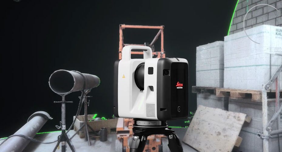
Leica Geosystems has officially introduced the next generation Leica RTC laser scanner lineup, bringing significant performance upgrades aimed at surveyors, construction professionals, engineers, and reality capture specialists. The new RTC Series focuses on faster scanning, real time collaboration, automated registration, and improved workflow integration, signaling Leica’s intention to push terrestrial laser scanning further into connected and data driven project environments.
The announcement positions the RTC family as more than a hardware refresh. Leica is promoting the platform as a complete field to office reality capture ecosystem capable of accelerating project delivery while maintaining high measurement accuracy.
Faster Scanning Performance
According to Leica’s specifications, the new RTC Series can capture up to 2,000,000 points per second while providing scanning ranges of up to 270 meters depending on the model. Leica claims the new generation delivers up to 3.5 times faster data capture and more than 35% greater accuracy than its nearest competitor.
The lineup consists of three models:
- RTC300
- RTC500
- RTC700
The RTC500 and RTC700 offer the highest acquisition speed, completing a full dome scan and HDR image capture in approximately 1 minute and 40 seconds at 6 mm resolution at 10 meters. The RTC300 completes the same workflow in roughly 2 minutes and 30 seconds.
For professionals working on infrastructure projects, industrial facilities, transportation corridors, and large construction sites, these time savings can translate into significantly higher daily productivity.
Real Time Registration and Cloud Connectivity
One of the most important advancements is Leica’s continued emphasis on connected workflows.
The RTC Series integrates Leica’s Visual Inertial System (VIS), which automatically tracks scanner movement and performs real time scan registration during data acquisition. This reduces dependence on traditional manual registration workflows and helps users validate data quality while still on site.
Leica also highlights Livelink connectivity through Cyclone FIELD 360 and Hexagon GeoCloud, enabling:
- Real time field to office data sharing.
- Crew to crew collaboration.
- Remote project monitoring.
- Multi scanner coordination.
This capability addresses one of the industry’s biggest challenges: discovering missing data only after returning from the job site.
High Resolution Imaging System
The new RTC scanners incorporate a sophisticated imaging platform featuring six cameras with a combined 72 MP sensor system.
The system captures:
- 432 MP of raw HDR image data.
- 174 MP calibrated spherical imagery.
- 360° × 300° field of view.
- Full HDR image generation in approximately 30 seconds.
Automatic exposure and white balance functions are designed to simplify operation across varying lighting conditions, making the scanners suitable for indoor, outdoor, industrial, and infrastructure applications.
Accuracy Specs
Leica continues to target the premium segment of the laser scanning market with impressive accuracy figures.
Key performance specifications include:
- Angular accuracy: 10 arc seconds.
- Range accuracy: 1.2 mm + 10 ppm.
- 3D point accuracy: 1.5 mm at 10 m.
- Range noise: 0.2 mm at 10 m.
- Highly accurate IMU based tilt compensation.
The RTC700 additionally supports ultra high resolution area scanning down to 0.8 mm at 10 meters, providing greater detail capture for engineering and inspection applications.
Built for Harsh Job Sites
Leica has maintained a strong focus on field durability.
The scanners feature:
- IP55 environmental protection.
- Operating temperatures from -20°C to +50°C.
- Automatic self calibration during normal operation.
- Integrated GNSS and shock sensors.
- 512 GB internal SSD storage.
- Wi Fi 6 connectivity.
- USB C data transfer.
The system weighs approximately 5.5 kg without batteries and can operate for up to four hours using dual internal lithium ion batteries.
Why RTC Could Change Surveying Workflows
The reality capture market is increasingly shifting away from isolated scanning devices toward connected data collection ecosystems. Leica’s new RTC Series reflects that trend.
While raw scanning speed remains important, the larger innovation may be workflow intelligence. Automated registration, cloud synchronization, and real time collaboration reduce the amount of manual processing that traditionally consumed significant portions of laser scanning projects.
The strongest aspect of the new RTC platform is not necessarily the 2 million points per second headline. The real value lies in shortening the time between field acquisition and deliverable generation. For surveying firms and construction teams operating under tight deadlines, reducing office processing time often creates a greater financial impact than simply collecting more points.
If Leica’s claims regarding accuracy, automation, and workflow integration prove consistent in real world projects, the RTC Series could become one of the most influential terrestrial laser scanning platforms introduced in recent years.
About Leica Geosystems
Founded in 1921, Leica Geosystems is one of the world’s leading providers of surveying, reality capture, geospatial measurement, and mapping technologies. The company operates as part of Hexagon, a global technology group with operations in more than 50 countries and approximately 24,000 employees worldwide. Leica solutions are widely used across surveying, construction, mining, utilities, transportation, manufacturing, and public infrastructure projects.
Source: leica-geosystems.com


