Woncan and Swift Navigation have announced a partnership that combines compact LiteSurvey GNSS receivers with the Skylark Nx RTK correction service, allowing field professionals to collect centimeter-accurate positioning data directly through their smartphones. Announced on October 21, 2026, the collaboration targets surveying, GIS mapping, construction, forestry, and infrastructure inspection teams seeking a portable alternative to conventional RTK equipment.
The solution integrates Woncan’s LiteSurvey receiver family and LiteSurvey Pro mobile application with Swift Navigation’s cloud-based correction infrastructure. Users can receive network RTK corrections through a smartphone’s cellular connection without installing or operating their own GNSS base station.
The partnership also introduces a promotional package that includes six months of Skylark Nx RTK service with qualifying LiteSurvey purchases made before December 31, 2026.
LiteSurvey GNSS Receivers and Specs
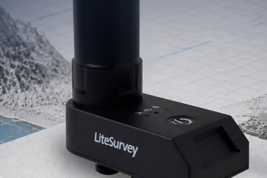
Woncan’s LiteSurvey product family is designed around lightweight GNSS receivers that connect to smartphones, reducing the need for dedicated field controllers. Depending on the model, the devices support multi-frequency satellite positioning, tilt compensation, and contactless point measurement.
The LiteSurvey 2 Pro, for example, weighs only 66 grams and measures 73 × 34 × 18 mm. It incorporates a 1,300 mAh battery providing up to eight hours of operation in multi-band mode or approximately five hours with tilt compensation enabled.
The smaller LiteSurvey 2 mini weighs just 26 grams and draws power directly from a connected smartphone through USB-C. The standard LiteSurvey 2 weighs 41 grams and offers up to ten hours of battery operation in dual-band mode.
Across the product range, supported GNSS constellations include GPS, GLONASS, Galileo, and BeiDou, with available signal combinations varying by receiver configuration. The devices also provide IP53 protection against dust and water spray.
| Receiver | Weight | Power Source | Key Feature |
|---|---|---|---|
| LiteSurvey 2 mini | 26 g | Smartphone USB-C | Extremely compact positioning |
| LiteSurvey 2 | 41 g | 900 mAh battery | Dual-band and multi-band options |
| LiteSurvey 2 Pro | 66 g | 1,300 mAh battery | Tilt compensation |
| LiteSurvey Range | 120 g | 1,500 mAh battery | Tilt compensation and 20 m laser ranging |
The LiteSurvey Range model adds a laser measurement system for recording coordinates of points up to 20 meters away, potentially useful for collecting positions near obstacles or inside areas that cannot be safely approached. Woncan currently lists this model as coming soon.
Skylark Nx RTK Correction Technology
The positioning service is the most technically significant component of the partnership.
Swift Navigation’s Skylark Nx RTK uses network-based real-time kinematic positioning supported by continuously operating reference stations and cloud processing. Rather than relying on a single nearby reference station, the system combines network observations with atmospheric modeling to generate corrections appropriate for the receiver’s location.
Swift specifies positioning accuracy of approximately 1-2 centimeters under suitable operating conditions.
The service uses Virtual Reference Station technology and supports standard NTRIP interfaces, allowing compatible GNSS receivers to access corrections over an internet connection.
Published Skylark Nx RTK specs:
| Parameter | Skylark Nx RTK Specification |
|---|---|
| Correction technology | Network RTK with VRS and atmospheric modeling |
| Positioning accuracy | 1-2 cm under specified conditions |
| RTK convergence | Near-instant under favorable conditions |
| Correction delivery | Internet connection using NTRIP |
| NTRIP versions | 1.0 and 2.0 |
| RTCM formats | RTCM 3.1 and RTCM 3.2 MSM5 |
| GNSS constellations | GPS, Galileo, BeiDou |
| Supported reference frames | ITRF2020, WGS84, NAD83, ETRS89, DREF91 |
| Advertised reference-station reach | Up to 70 km from the nearest station |
Swift attributes part of its network efficiency to a proprietary atmospheric model that combines machine learning with physics-based constraints. The technology is designed to account for ionospheric disturbances and maintain correction quality over longer distances between reference stations.Actual accuracy depends on satellite visibility, receiver characteristics, correction availability, multipath interference, and operating conditions. The specified accuracy of the correction service should not be interpreted as an independently verified performance guarantee for every LiteSurvey receiver.
How Smartphone-Based RTK Works
In the combined Woncan and Swift Navigation system, the smartphone becomes the central interface between the GNSS receiver, correction network, and field operator.
The workflow follows several steps:
- The LiteSurvey receiver tracks satellite signals and generates GNSS observations.
- The smartphone connects to Skylark through mobile internet.
- Skylark generates network RTK corrections using its reference-station infrastructure.
- Correction data is delivered to the compatible GNSS receiver.
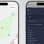
- The LiteSurvey Pro application allows the operator to record coordinates and manage field measurements.
Woncan’s software also supports coordinate transformations and local projected coordinate systems through its geodetic processing capabilities.
This architecture removes the operational burden of installing a personal base station, but it does not eliminate the need for reference-station infrastructure.
Skylark still depends on a distributed network of permanent GNSS reference stations, and users need suitable internet connectivity to receive real-time corrections.
RTK Coverage Across Three Continents
At launch, the integrated solution is offered in supported parts of Europe, Asia, and North America.
Swift Navigation has previously reported continuous 1-2 cm positioning coverage across 28 Western European countries, with additional regional coverage in seven Eastern European countries.
However, service availability differs geographically, and broad regional availability should not be confused with uninterrupted coverage at every location.
Surveyors working in remote forestry areas, construction sites with limited mobile reception, or regions with sparse reference-station infrastructure should verify both Skylark coverage and cellular connectivity before deployment.
What the Woncan and Swift Partnership Means for RTK Users
The most interesting aspect of this announcement is not the centimeter-level accuracy itself. Network RTK has offered comparable positioning performance for years.
The meaningful development is the integration of affordable, highly portable receiver hardware with a commercial correction service and smartphone-based field software.
Traditional professional surveying workflows frequently involve a GNSS rover, survey pole, dedicated controller, and a separately configured correction subscription. These systems remain appropriate for demanding geodetic work, but their complexity can be unnecessary for routine asset mapping and inspection.
Woncan and Swift are addressing a different category of user: professionals who need reliable coordinates as part of their daily work without operating a complete surveying equipment setup.
The potential advantage is particularly relevant to utility inspection, municipal GIS maintenance, forestry inventories, and construction documentation.
There are also important limitations.
First, centimeter-level positioning accuracy does not automatically establish the accuracy of a complete field measurement. Antenna placement, tilt calibration, coordinate transformations, laser geometry, and operator procedures all contribute to the final result.
Second, the smartphone-centered design introduces dependence on mobile connectivity, device compatibility, and application reliability.
Third, buyers should consider subscription costs after the introductory service period. An inexpensive or compact receiver is not necessarily the lowest-cost solution over several years.
The broader significance is that professional GNSS positioning is becoming more modular. Hardware manufacturers can concentrate on receiver design and field usability, while specialized correction providers operate the reference-station networks and cloud infrastructure.
For CORS network operators, this trend could create additional demand for reliable regional correction infrastructure rather than reduce its importance.
Skylark Nx RTK Launch Promotion
To support the partnership, Woncan and Swift Navigation have introduced a limited-time promotional offer.
Customers purchasing eligible LiteSurvey equipment before December 31, 2026, receive six months of Skylark Nx RTK corrections at no additional subscription charge.
A separate 20% discount is available on qualifying one-year, three-year, and five-year Skylark Nx RTK subscriptions purchased before the same deadline.
The companies have not specified a universal subscription price in their partnership announcement. Pricing and eligibility should be confirmed through the official promotion page.
About Woncan and Swift Navigation
Woncan is a Hong Kong-based developer of compact GNSS positioning hardware and mobile surveying software. Its LiteSurvey family includes receivers weighing from 26 grams to 120 grams, with selected models supporting multi-band positioning, tilt compensation, and laser measurements over distances of up to 20 meters. The product range is designed for GIS, land management, construction, and field surveying applications.
Swift Navigation is a San Francisco-based precise-positioning technology company developing GNSS correction services for automotive systems, robotics, industrial automation, and connected devices. Its Skylark platform supports more than 10 million vehicles and devices worldwide. The company’s correction-service portfolio includes Skylark Nx RTK for centimeter-level positioning, Skylark Cx for decimeter-level applications, and Skylark Dx for lower-precision positioning requirements.