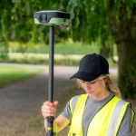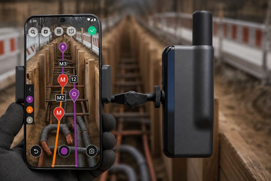
Construction surveying has steadily evolved toward greater mobility, but many workflows still rely on multiple devices, desktop software, cloud platforms, and experienced survey specialists. German developer Netpipe is aiming to simplify that process with the launch of 3tag, a fully self contained handheld surveying solution that combines high precision GNSS positioning, integrated RTK corrections, laser measurement, onboard data processing, and offline artificial intelligence in a single field device.
Rather than competing with high end robotic total stations or professional geodetic equipment, 3tag targets the much larger segment of everyday construction and landscaping operations where speed, simplicity, and immediate decision making often matter more than millimeter level precision.
Integrated RTK GNSS System
The core of the new platform is a modern multi constellation GNSS receiver operating with an integrated RTK correction service capable of delivering centimeter level positioning immediately after deployment.
Unlike conventional surveying systems that often require separate GNSS receivers, correction subscriptions, field software, office processing, and report generation, Netpipe integrates every component into one closed ecosystem.
The workflow allows operators to:
- Capture survey grade coordinates.
- Record site features.
- Calculate cut and fill volumes.
- Generate terrain models.
- Export DXF files.
- Produce finished field reports directly on the handheld device.
Because all processing occurs locally, users avoid transferring data between multiple applications before receiving usable results.
Automatic Laser Height Compensation
One of the more practical engineering features is the built in laser distance measurement module.
Instead of manually measuring antenna height or applying correction values during post processing, the system automatically determines and compensates for device height while collecting field data.
This automation reduces several common sources of surveying errors:
- Incorrect rod height entries.
- Manual calculation mistakes.
- Repeated measurements.
- Additional office corrections.
For construction crews that perform frequent topographic checks or earthwork measurements, eliminating these repetitive steps can significantly reduce total survey time.
Closed Workflow Without Cloud Processing
Perhaps the most distinctive design philosophy behind 3tag is its complete independence from cloud infrastructure.
Every major function operates directly on the handheld device, including:
- GNSS positioning.
- Laser measurement.
- Data processing.
- Volume calculations.
- Reporting.
- File export.
- AI assistance.
This architecture offers several practical advantages.
Construction projects frequently operate in locations with unreliable mobile coverage, making cloud based workflows less efficient. Since all calculations remain on the device, field teams can continue working without internet connectivity while avoiding delays caused by synchronization or remote processing.
The closed system also removes the complexity of maintaining multiple software licenses, external applications, and separate reporting platforms.
Offline AI Assistant
An unusual feature for a surveying instrument is its integrated offline AI assistant.
Unlike cloud based assistants that require continuous connectivity, the onboard system operates entirely from a locally stored German knowledge base.
Users can ask questions by voice or text to receive guidance on measurement procedures or navigation through the software interface.
Importantly, the AI does not modify collected survey data automatically. Instead, it functions as an intelligent training assistant that helps operators complete tasks correctly while leaving all measurement decisions under user control.
This makes the system particularly attractive for organizations that regularly onboard new personnel with limited surveying experience.
Designed for Construction Productivity
Netpipe positions 3tag primarily as a productivity tool rather than a replacement for professional survey departments.
The intended users include:
- Construction contractors.
- Earthmoving companies.
- Landscaping businesses.
- Utility installation crews.
- Infrastructure maintenance teams.
For these organizations, immediate access to accurate positioning information can eliminate delays caused by waiting for dedicated surveying specialists before routine site decisions can be made.
Instead of measuring today and processing tomorrow, crews can complete the entire workflow during a single field visit.
Technical Perspective
From a technical standpoint, Netpipe appears to be following a growing industry trend toward workflow integration instead of focusing solely on positioning accuracy.
Centimeter RTK GNSS has become increasingly common across professional surveying hardware. The real innovation here lies in reducing the number of separate systems required to transform raw coordinates into actionable construction information.
Combining RTK positioning, laser measurement, local computing, automated reporting, and offline AI into one tightly integrated device addresses one of the industry’s biggest inefficiencies: fragmented workflows. While professional surveyors will continue relying on high precision total stations, laser scanners, and advanced GNSS receivers for complex geodetic tasks, solutions like 3tag could significantly expand access to accurate field surveying for ordinary construction crews that need reliable results without specialist expertise.
If the platform proves robust under demanding site conditions, its biggest competitive advantage may not be accuracy alone, but the dramatic reduction in training time, software complexity, and project delays.
About Netpipe
Netpipe is a German technology company focused on developing integrated digital solutions for construction and field operations. With the introduction of 3tag, the company delivers a fully in house platform where the hardware, GNSS engine, software stack, laser measurement system, reporting tools, and offline AI assistant are all developed as one unified ecosystem. Unlike many surveying vendors that combine third party hardware and software, Netpipe emphasizes complete vertical integration to simplify deployment and reduce operational complexity for construction professionals.