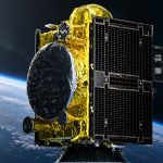
China has completed an in-orbit upgrade of the BeiDou Navigation Satellite System, optimizing parts of the operational constellation while keeping positioning, navigation and timing services available to users worldwide.
The China Satellite Navigation Office said the work was intended to improve service quality and prepare the system for the introduction of new navigation technologies. The upgrade reportedly included adjustments to the operational status of selected satellites rather than the deployment of an entirely new constellation.
BeiDou Satellite Upgrade
BeiDou currently operates 50 satellites and provides global positioning accuracy of better than 10 meters under standard open-service conditions.
The system also delivers velocity measurement accuracy better than 0.2 meters per second and timing accuracy within 20 nanoseconds, according to figures released by the China Satellite Navigation Office.
Completing the upgrade while maintaining stable operations is technically significant. Satellite navigation networks must continuously manage spacecraft health, orbital parameters, clock performance, signal availability and ground-control coordination. Changes involving active satellites can therefore affect service continuity if they are not carefully scheduled and validated.
The latest operation appears to have focused on improving how existing orbital assets are used. This approach can extend constellation efficiency and strengthen service reliability without requiring every improvement to come from a new satellite launch.
BeiDou PPP Accuracy
One of the most important technical capabilities highlighted after the upgrade is BeiDou’s Precise Point Positioning service.
Using the PPP-B2b signal, the system can provide horizontal positioning accuracy better than 0.3 meters and vertical accuracy better than 0.6 meters under suitable operating conditions.
PPP differs from conventional standalone GNSS positioning because it applies precise satellite orbit and clock correction data to improve the position calculated by a compatible receiver. It can deliver substantially higher accuracy without requiring a nearby local base station, although convergence time, receiver quality, signal visibility and atmospheric conditions remain important.
For agriculture, construction, surveying, autonomous machinery and infrastructure monitoring, this type of satellite-delivered correction service can reduce dependence on local correction networks in regions where RTK coverage is limited.
However, BeiDou PPP should not automatically be treated as a direct replacement for network RTK in every application. RTK systems can still provide faster initialization and centimeter-level repeatability for demanding operations such as precision planting, controlled traffic farming and machine guidance.
The stronger opportunity is the combination of technologies. Equipment manufacturers can use PPP as a wide-area positioning layer, then integrate RTK, inertial sensors, cameras or local reference stations when greater accuracy and operational redundancy are required.
Global GNSS Competition
The upgrade strengthens BeiDou’s position alongside GPS, Galileo and GLONASS as one of the world’s major global navigation satellite systems.
Modern receivers increasingly use several constellations simultaneously rather than relying on a single provider. Additional satellites improve geometry, reduce positioning interruptions and help receivers maintain performance near buildings, trees, terrain obstacles and other environments where parts of the sky are blocked.
For equipment manufacturers, the practical value of BeiDou is therefore not limited to China. Support for BeiDou signals can increase the total number of satellites available to multi-constellation receivers and improve the resilience of navigation systems used in global markets.
The next stage of development will extend beyond maintaining the current BDS-3 constellation. China previously announced plans to begin launching experimental satellites for a next-generation BeiDou architecture around 2027. Deployment is expected to begin around 2029, with completion targeted for 2035. The future system is expected to combine satellites in high, medium and low Earth orbits.
Technical Assessment
The most important part of this announcement is not the phrase “in-orbit upgrade” itself, but the operational strategy behind it.
BeiDou is moving from the construction phase of a global GNSS constellation into a continuous modernization cycle. This is the same challenge faced by every mature navigation system: maintaining uninterrupted service while satellites age, user requirements become more demanding and positioning technology moves toward autonomous vehicles and safety-critical applications.
The reported performance figures are already sufficient for mass-market navigation, fleet tracking and many industrial applications. The greater long-term value will depend on integrity monitoring, correction availability, receiver compatibility and how consistently high-precision services perform outside controlled demonstrations.
For precision agriculture, BeiDou’s strongest role may be as part of multi-GNSS positioning rather than as a standalone ecosystem. Agricultural receivers that combine BeiDou, GPS, Galileo and GLONASS can obtain better satellite visibility and stronger positioning geometry. When combined with RTK corrections and inertial measurement systems, that can improve guidance stability near tree lines, buildings and uneven terrain.
The upgrade therefore represents an incremental technical step rather than a dramatic change in positioning accuracy. Its significance lies in keeping the constellation efficient, reliable and ready for a new generation of automated machines that will require continuous positioning rather than occasional navigation.
About BeiDou
The BeiDou Navigation Satellite System is China’s independently developed global satellite navigation platform.
Development began in 1994. The BDS-1 regional system was completed in 2000, followed by BDS-2 in 2012. BDS-3 entered global service on July 31, 2020. Its core global constellation was designed around 24 medium Earth orbit satellites, three geostationary satellites and three inclined geosynchronous orbit satellites.
BeiDou currently has 50 operational satellites. Its products and services had reached more than 140 countries and regions by the end of 2024.
China’s satellite navigation and positioning services industry generated 575.8 billion yuan, approximately $79.9 billion, in 2024, representing annual growth of 7.39 percent. The core segment covering chips, algorithms and terminal equipment generated 169.9 billion yuan.
Approximately 288 million mobile phones in China supported BeiDou-enabled positioning by the end of 2024. The system was also delivering more than 1 trillion location services per day and supporting over 4 billion kilometers of daily navigation activity.