DJI has rolled out version 5.2.0 of its Terra platform, continuing a steady push toward tighter integration between its drone hardware and data processing ecosystem. The update focuses less on introducing new workflows and more on removing friction from existing ones, with noticeable gains in speed, automation, and output quality for professional users in surveying, construction, and inspection.
HEIF support for Zenmuse L3 and COG export streamline GIS workflows
A key addition in this release is support for HEIF image imports, currently limited to datasets captured with the Zenmuse L3 payload. While hardware-specific, this move signals DJI’s broader strategy to align capture formats more closely with processing efficiency, especially for high-resolution mapping missions.
Equally relevant for GIS professionals is the introduction of Cloud Optimized GeoTIFF export. By enabling COG output, DJI Terra reduces the friction of moving large orthomosaic datasets into GIS environments. Faster loading and improved compatibility with cloud-based tools directly impact how quickly teams can move from data capture to analysis.
Automated ground control point recognition reduces manual processing time
DJI is also addressing one of the most time-consuming steps in photogrammetry. The new automatic mark identification feature for datasets collected with D-RTK 3 significantly cuts down on manual ground control point marking.
This is not just a convenience upgrade. In high-volume mapping operations, reducing manual input translates into fewer human errors and faster turnaround times, especially when processing multiple missions per day.
Multi-core optimization and High Efficiency Mode accelerate large dataset reconstruction
Performance tuning is a major focus in version 5.2.0. Users can now control how CPU cores are allocated or switch to a High Efficiency Mode designed to speed up reconstruction.
In practical terms, this directly impacts processing-heavy workflows such as corridor mapping, mining surveys, and large-scale infrastructure projects. Faster reconstruction means shorter project cycles and better utilization of both hardware and personnel.
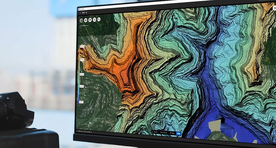
LiDAR aerotriangulation improvements increase point cloud accuracy
On the LiDAR side, DJI has refined aerotriangulation algorithms to improve trajectory estimation. This leads to more accurate point clouds, particularly in complex environments where positioning errors can compound quickly.
Additional improvements in base station data parsing further enhance positional reliability, which is critical for applications like topographic surveying and digital twin generation.
Improved orthophoto quality and faster 3D Gaussian Splatting processing
The visual output pipeline has also been upgraded. Orthophoto maps generated from oblique imagery now show more consistent color balance and sharper detail.
At the same time, enhancements to 3D Gaussian Splatting improve both rendering speed and model quality in higher detail modes. This is especially relevant for users creating presentation-ready 3D models or conducting visual inspections.
Noise reduction and accuracy optimization are now enabled by default in visible-light point cloud workflows, removing the need for additional configuration and ensuring cleaner outputs out of the box.
Practical limitations and bug fixes for enterprise users
DJI has addressed a known issue with contour line intervals when working in imperial units, a fix that will be particularly relevant for US-based professionals.
However, some limitations remain. HEIF support is restricted to Zenmuse L3 datasets, and Windows users still face the 260-character file path limitation during multi-core processing, which can affect large project structures.
What this update changes in real workflows
This release is less about headline features and more about cumulative efficiency gains. DJI is clearly optimizing for time savings across the entire pipeline, from data ingestion to final output.
For enterprise users, the impact is direct. Faster reconstruction reduces hardware bottlenecks, automated marking cuts labor costs, and improved accuracy lowers the risk of rework. In industries where margins depend on throughput and precision, these incremental improvements compound quickly.
More importantly, the tighter coupling between DJI hardware and Terra software reinforces a closed ecosystem strategy. Users who adopt DJI’s full stack are likely to see the biggest efficiency gains, which strengthens customer retention but also raises the barrier for mixed-hardware workflows.
About DJI
DJI, headquartered in Shenzhen, China, is the global leader in civilian drone technology, with an estimated market share exceeding 70% in the commercial drone segment. The company serves customers in over 100 countries and operates with a workforce of more than 14,000 employees.
Its product portfolio spans consumer drones, enterprise UAV platforms, camera stabilization systems, and software solutions like DJI Terra. In the enterprise segment, DJI’s ecosystem is widely used across surveying, agriculture, energy, and public safety, positioning the company as a dominant player in both hardware and data processing workflows.


