A UK-based geospatial technology company, Envisage Space Ltd., has unveiled a new analytical approach to one of GNSS positioning’s most persistent problems: accuracy degradation in dense urban environments. Developed in collaboration with Cranfield University and supported by the European Space Agency’s NAVISP program, the solution targets real-world operational challenges where positioning errors directly impact service performance.
The system, called RelyMap Connect, was recently presented at an ESA-hosted event, highlighting its application in micromobility ecosystems such as shared e-scooters and bikes, where reliable positioning is essential for geofencing, parking compliance, and fleet monitoring.
How Predictive GNSS Modeling Solves Urban Signal Degradation Challenges
Urban environments remain one of the most complex scenarios for satellite positioning due to signal blockage, multipath reflections, and inconsistent satellite visibility at street level. Traditional GNSS processing struggles to maintain accuracy in these conditions, leading to false geofence violations and operational inefficiencies.
RelyMap Connect addresses this by combining predictive modeling with real-time GNSS data. The platform leverages high-resolution 3D city models to simulate satellite visibility and forecast positioning performance before errors occur. This predictive layer is then fused with live multi-constellation GNSS measurements and device telemetry.
Machine learning algorithms analyze discrepancies between expected and actual signal behavior, enabling the system to detect when positioning reliability is degrading. Instead of reacting to errors after they occur, operators gain foresight into when and where GNSS performance will become unreliable.
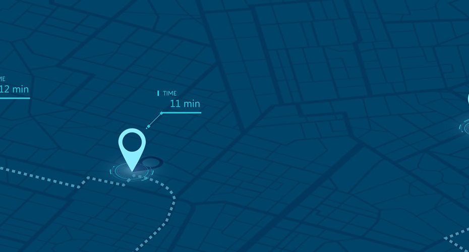
Real-Time Confidence Metrics Enable Smarter Geofencing Decisions
One of the most practical outputs of the system is a dynamic “confidence factor” assigned to each positioning solution. This metric quantifies the reliability of GNSS data in real time, allowing operators to make informed decisions about whether positioning accuracy meets operational thresholds.
In field demonstrations across multiple UK cities, this capability proved particularly valuable for micromobility operators. By identifying zones with predictable GNSS degradation, companies were able to adjust geofence boundaries, reduce false parking violations, and improve regulatory compliance.
This represents a shift from static geofencing toward adaptive geofencing models, where rules can be dynamically adjusted based on positioning reliability rather than fixed coordinates.
Cloud-Based GNSS Analytics Platform Scales Across Entire Cities
RelyMap Connect operates as a cloud-based analytical platform, capable of continuously evaluating GNSS performance across large urban areas. Instead of relying solely on onboard device calculations, the system aggregates environmental modeling, historical data, and live measurements into a centralized intelligence layer.
This architecture enables city-wide visibility into positioning reliability, opening the door to broader applications beyond micromobility. Potential use cases include autonomous delivery systems, urban robotics, smart city infrastructure, and safety-critical navigation services.
Why This Matters for the Future of GNSS
From a technical standpoint, this development reinforces a growing industry trend: GNSS alone is no longer sufficient in challenging environments. The future of positioning lies in hybrid approaches that combine satellite data with environmental context, predictive analytics, and AI-driven validation layers.
What Envisage Space is building aligns closely with the evolution toward integrity-aware positioning systems. Instead of focusing purely on accuracy, the industry is shifting toward reliability and trust metrics, especially in applications where incorrect positioning can lead to financial, regulatory, or safety consequences.
This is particularly relevant for sectors like precision agriculture, autonomous machinery, and urban mobility, where decision-making increasingly depends on verified positioning quality rather than raw coordinates.
From Micromobility to Autonomous Systems
While the initial focus is micromobility, the implications extend much further. Any system operating in GNSS-challenged environments can benefit from predictive reliability modeling.
For example:
- urban delivery robots navigating narrow streets;
- autonomous vehicles operating in dense cities;
- construction and surveying workflows near high-rise structures;
- even precision agriculture in areas with partial signal obstruction.
As urban environments become more connected and automated, solutions like RelyMap Connect could become a foundational layer in positioning infrastructure, similar to how RTK networks transformed high-precision applications in open environments.
About Envisage Space
Envisage Space Ltd. is a UK-based geospatial analytics company specializing in GNSS performance modeling and positioning intelligence. Its core RelyMap platform uses high-resolution 3D mapping and satellite simulation to predict GNSS behavior at street level with high spatial accuracy.
The RelyMap Connect project was developed under the European Space Agency’s NAVISP program, which funds advanced positioning, navigation, and timing innovations across Europe. The collaboration with Cranfield University brings additional academic expertise in GNSS signal processing and machine learning.
Key highlights:
- ESA-backed development under NAVISP initiative;
- integration of multi-constellation GNSS data;
- use of detailed 3D urban models for predictive analytics;
- cloud-based architecture scalable to city-wide deployments;
- real-world validation across multiple UK urban environments.
With commercialization discussions already underway involving operators and city authorities, the project is moving beyond research toward real deployment scenarios.


