Topcon Positioning Systems is set to showcase a significantly expanded Capture Reality® ecosystem at CONEXPO CON AGG 2026, introducing a new generation of mobile SLAM scanners, high resolution laser systems, and GNSS integrated 3D capture tools designed to streamline construction, layout, and reality capture workflows.
The announcement reinforces Topcon’s strategy to unify scanning, positioning, and processing into a single connected workflow that reduces field time, minimizes rework, and delivers survey grade accuracy across complex job sites.
Mobile SLAM Scanning with RTK GNSS Integration for Construction and Infrastructure Projects
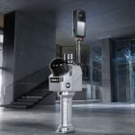
The CR S2 mobile SLAM system leads the new lineup with elevated scanning capabilities that combine high quality point cloud capture and real time colorized imaging. Integrated with Topcon correction services, the system delivers centimeter level positioning accuracy while maintaining the flexibility of mobile operation.
Designed for demanding construction and infrastructure environments, CR S2 enables professionals to collect actionable 3D data in a single workflow. The goal is clear. Reduce return visits and eliminate costly rework through instant and reliable spatial information.
The CR S1 builds on this approach with a highly portable single operator configuration. Supporting multiple output formats and an all in one workflow, the device targets surveyors and contractors who need precise point cloud accuracy and simplified data sharing in fast paced field conditions.
High Resolution Laser Scanning with CR P1 for Detailed 3D Site Capture
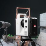
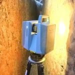
For applications requiring static, high detail scanning, the CR P1 delivers long range 3D capture with models supporting 100 meter and 200 meter configurations. Engineered for fast deployment and seamless integration into processing software, CR P1 is positioned for projects that demand detailed structural analysis, facility documentation, and large site mapping.
The system emphasizes speed, lightweight design, and durable field performance, enabling scanning teams to move efficiently while maintaining high data integrity.
SLAM Based Layout Positioning with Origo Technology
Topcon’s Origo technology introduces SLAM based positioning specifically tailored for layout workflows. The solution addresses line of sight limitations often encountered in GNSS or total station operations.
By combining SLAM algorithms with robust field hardware, Origo ensures that layout points are placed accurately in complex or obstructed environments. The system is engineered to maintain consistency in indoor construction zones, partially enclosed structures, and dense job sites where conventional positioning methods may struggle.
CR M1 Backpack Mobile Mapping for Complex and Confined Environments
The CR M1 expands mobility further with a backpack based mobile mapping configuration. Designed for tight or obstructed environments, the system allows operators to capture accurate and colorized point clouds simply by walking through the site.
This configuration is particularly suited for industrial facilities, interior construction, renovation projects, and infrastructure corridors where tripod based scanners are impractical.
CR H1 GNSS Integrated 3D Capture with HiPer CR and PIX4Dcatch
The CR H1 solution integrates HiPer CR GNSS with PIX4Dcatch on iPhone, combining RTK accuracy with augmented reality visualization. This configuration provides an accessible yet professional grade 3D capture workflow.
Flexible setup options, including ergonomic handles or GNSS pole mounting, enable field crews to generate high precision 3D models that support inspection, layout verification, and as built documentation with minimal training requirements.
Capture Reality Ecosystem Strategy Focused on One Unified Workflow
Across all systems, the unifying theme is a single integrated workflow that connects scanning, GNSS positioning, correction services, and data processing. Topcon’s emphasis is on reducing friction between field capture and office deliverables, allowing contractors and surveyors to make faster, data driven decisions.
By integrating correction services and optimized processing pipelines, the Capture Reality ecosystem aims to improve accuracy, compress project timelines, and enhance collaboration between field and office teams.
About Topcon Positioning Systems
Topcon Positioning Systems is a global provider of precision measurement and workflow solutions for construction, surveying, agriculture, and geospatial markets. The company operates in more than 100 countries and is part of Topcon Corporation, founded in 1932 and headquartered in Tokyo, Japan. Topcon Corporation reported annual revenues exceeding approximately 200 billion Japanese yen in recent fiscal years and employs thousands of professionals worldwide across its positioning, smart infrastructure, and eye care divisions.
About CONEXPO CON AGG 2026
CONEXPO CON AGG 2026 will take place March 3 to March 7, 2026, at the Las Vegas Convention Center in Las Vegas, Nevada. Recognized as North America’s largest construction trade show, the event gathers thousands of exhibitors and more than one hundred thousand industry professionals to explore the latest equipment, technology, and digital solutions shaping the future of construction.