CHCNAV has officially teased the upcoming release of its new airborne LiDAR platform, the AlphaAir 6, positioning it as a next-generation solution for UAV-based mapping and geospatial data acquisition. The announcement, centered around the message “Capture More. Map Smarter.”, signals a clear focus on improving data density, efficiency, and workflow integration rather than simply pushing raw hardware specifications.
The official launch is scheduled for April 9, with full technical details expected to be revealed at that time.
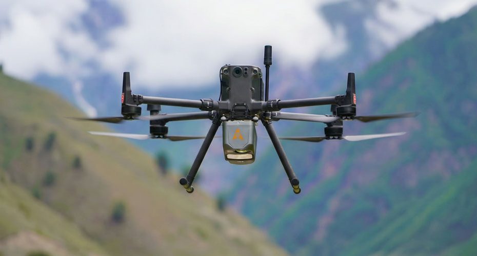
AlphaAir 6 airborne LiDAR system positioning and expected use cases in UAV mapping
Based on the teaser, the AlphaAir 6 is being positioned as a flagship airborne LiDAR system designed for professional users operating in surveying, infrastructure inspection, and environmental monitoring.
Systems in this category are typically used for:
- Topographic mapping in complex or vegetated terrain.
- Corridor mapping for roads, railways, and powerlines.
- Forestry analysis, including canopy penetration and biomass estimation.
- Mining volumetrics and stockpile measurement.
- Flood modeling and terrain analysis.
The emphasis on “capture more” suggests improvements in point cloud density and coverage efficiency, while “map smarter” points toward workflow optimization and reduced processing time.
CHCNAV AlphaAir lineup comparison highlights market gap for AlphaAir 6
To better understand where the AlphaAir 6 fits, it is useful to look at CHCNAV’s existing AlphaAir lineup, which is clearly structured across three performance tiers.
The AlphaAir 450 serves as an entry to mid-level system, offering a range of up to 450 meters, a scan rate of up to approximately 720,000 pulses per second, and up to three returns per pulse. It is designed for general mapping tasks where efficiency and cost control are priorities.
The AlphaAir 10 moves into the professional segment, extending range to around 800 meters, supporting up to eight returns, and delivering sub-5 centimeter accuracy. This makes it suitable for more demanding surveying environments, especially where vegetation penetration is required.
At the high end, the AlphaAir 15 targets large-scale and high-complexity projects. It offers a range of up to 1,800 meters, scan rates approaching 2 million pulses per second, and up to 16 returns, making it suitable for corridor mapping, forestry, and energy infrastructure projects.
This lineup reveals a clear performance gap between the AlphaAir 10 and AlphaAir 15, particularly in scan rate, return capability, and operational range.
Expected AlphaAir 6 specifications based on current product segmentation
Given that gap, the AlphaAir 6 is likely designed to occupy the upper-mid segment of the market.
While CHCNAV has not yet confirmed specs, a logical positioning would include:
- Scan rate in the range of 1 to 1.5 million pulses per second.
- Support for approximately 8 to 12 returns per pulse.
- Effective range between 800 and 1,200 meters.
- Consistent sub-5 centimeter accuracy.
If these expectations are met, the AlphaAir 6 would bridge the gap between professional and premium systems, offering a balance between performance and cost that is highly relevant for commercial operators.
Focus shifts from raw LiDAR performance to workflow efficiency and integration
One of the most notable signals from the teaser is not about hardware alone, but about workflow.
The UAV LiDAR market has been shifting toward:
- Stronger integration between LiDAR, GNSS, and IMU systems.
- Reduced dependence on complex post-processing.
- Faster turnaround from data acquisition to deliverables.
CHCNAV has been building its ecosystem around these principles, and the AlphaAir 6 is expected to further streamline data pipelines, making it easier for operators to move from flight to usable datasets.
Another key factor is efficiency per flight. Optimized weight, power consumption, and sensor performance can significantly increase coverage area, directly improving project economics.
AlphaAir 6 could become CHCNAV’s core volume product in UAV LiDAR market
From a market standpoint, the AlphaAir 6 has the potential to become one of the most commercially important products in CHCNAV’s portfolio.
Entry-level systems drive adoption, while high-end systems serve niche, high-budget projects. However, the majority of demand sits in the middle, where performance, reliability, and cost must align.
If CHCNAV delivers a strong balance between capability and pricing, the AlphaAir 6 could become a primary platform for engineering firms, survey companies, and geospatial service providers scaling UAV-based LiDAR operations.
About CHCNAV
CHCNAV, part of Huace Group, is a China-based manufacturer specializing in GNSS positioning, surveying, and geospatial technologies. The company operates in more than 140 countries and serves industries including agriculture, construction, marine, and geospatial mapping.
Key figures and positioning:
- Part of Huace Group, a publicly listed geospatial technology company.
- Global workforce of several thousand employees across R&D, manufacturing, and support.
- Strong presence in precision agriculture, GNSS receivers, and UAV mapping systems.
- Expanding rapidly in the airborne LiDAR segment with a focus on cost-performance balance.
This combination of scale, vertical integration, and aggressive global expansion has positioned CHCNAV as one of the fastest-growing players in the geospatial technology market.


