British navigation technology developer Voyant has successfully demonstrated a radar-based positioning system that allows an autonomous surface vessel to determine its location without GPS or other Global Navigation Satellite System (GNSS) signals. The trial, conducted for the UK Ministry of Defence in the Solent, represents another step toward maritime navigation systems capable of operating under electronic interference.
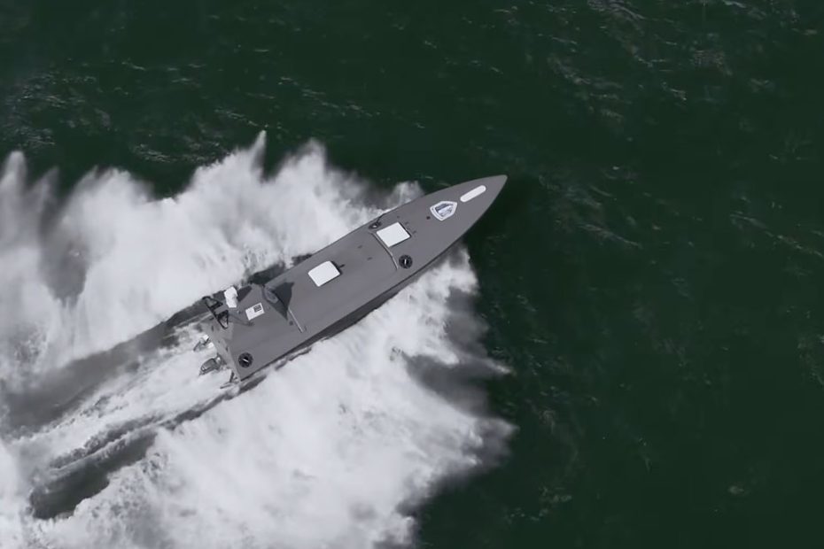
The demonstration, announced on October 5, 2026, used a Kraken K3 Scout equipped with Voyant’s navigation software. Instead of receiving positioning data from satellites, the vessel calculated its location by comparing live radar observations with previously prepared geographical reference maps.
How Radar-Based Navigation Works
Voyant’s technology uses particle-filter algorithms, a probabilistic approach that evaluates multiple possible vessel positions and updates their likelihood as new sensor information becomes available.
During the trial, onboard radar collected information about surrounding coastal features. The software compared these observations with stored reference maps to identify the vessel’s probable location. By continuously processing new measurements, the system could update its position estimate without depending on external satellite signals.
An important feature of this approach is its ability to estimate positioning uncertainty. Rather than reporting coordinates without any indication of confidence, the algorithm can evaluate how strongly the available radar observations support a particular location.
This is especially relevant for autonomous vessels because navigation software must make decisions based not only on where a platform appears to be, but also on how reliable that estimate is.
GNSS Jamming and Spoofing at Sea
Satellite navigation interference has become a growing operational challenge for both military and commercial shipping. GNSS jamming can prevent receivers from obtaining valid positioning signals, while spoofing can cause navigation equipment to calculate an incorrect location.
These threats are particularly concerning for unmanned vessels that depend on automated navigation and may have limited opportunities for direct human intervention.
Radar-based positioning offers an alternative because it relies on observations of the surrounding environment rather than radio signals transmitted by navigation satellites.
However, the technology is not entirely independent of external information. It requires suitable reference maps, recognizable geographical features and radar observations of sufficient quality.
In open waters far from coastlines or other stable radar targets, this approach may become less effective. Its performance can also be influenced by radar clutter, changing coastal conditions and inaccuracies in reference data.
For these reasons, radar map matching is better understood as an additional navigation capability within a resilient positioning architecture rather than a universal replacement for GNSS.
What the Kraken K3 Scout Trial Proves
The Solent provided a relevant testing environment because its coastal geography offers recognizable features for radar-based localization while presenting the complexity of real maritime operations.
The key achievement was demonstrating that the positioning algorithms could operate in real time aboard an actual autonomous vessel, rather than exclusively in simulation.
Nevertheless, an important technical question remains unanswered in the publicly available results: how accurately did the system maintain its position over extended periods without satellite updates?
Voyant has not published comprehensive figures covering horizontal positioning error, cumulative drift or performance under different operating conditions. These measurements will be essential for evaluating whether the technology can support demanding autonomous missions.
Another distinction concerns navigation autonomy itself. Successfully calculating a vessel’s position without GNSS does not automatically establish that every component of its navigation, collision avoidance and mission-control systems can function independently of satellite-based positioning.
Why This Technology Matters for Maritime PNT
The most significant aspect of Voyant’s development is its potential to reuse sensors already installed on many maritime platforms.
Modern vessels routinely employ radar for navigation, target detection and situational awareness. Extracting positioning information from that same sensor could provide an additional layer of resilience without requiring an entirely separate positioning infrastructure.
From a technical perspective, the strongest application would be a multi-sensor navigation architecture combining GNSS, inertial navigation, radar map matching and other available measurements.
Each system could compensate for the limitations of the others. When GNSS becomes unreliable, radar observations could help constrain inertial-navigation drift. When radar reference features are unavailable, inertial sensors could maintain a temporary position estimate until another reliable measurement becomes available.
The greater challenge is not simply generating alternative coordinates. It is developing software capable of recognizing when individual positioning sources become unreliable and adjusting their contribution to the navigation solution accordingly.
That is where particle-filter technology and advanced sensor fusion could make a particularly valuable contribution.
If future trials establish consistent accuracy across different maritime environments, the approach could eventually benefit autonomous survey vessels, offshore inspection platforms, hydrographic operations and commercial shipping, in addition to defense applications.
About Voyant and Kraken Technology
Voyant is a University of Liverpool spinout specializing in sensor fusion, tracking algorithms and alternative navigation technologies. Its software supports radar, sonar, optical, acoustic and electronic warfare applications. The company’s work includes particle-filter-based tracking and development using the open-source Stone Soup tracking framework.The trial platform was supplied by British maritime technology company Kraken Technology Group. According to the manufacturer’s published specifications, the K3 Scout has an 8.4-meter (27.6-foot) composite hull, a maximum speed of 55 knots, a payload capacity of 600 kilograms (1,323 pounds) and a range of 650 nautical miles at 25 knots. Mission-dependent endurance can reach 30 days.
The K3 Scout entered series production in Germany in April 2026 through Rheinmetall Kraken GmbH. Initial manufacturing plans target approximately 200 vessels annually, with potential capacity expansion to 1,000 units depending on demand.