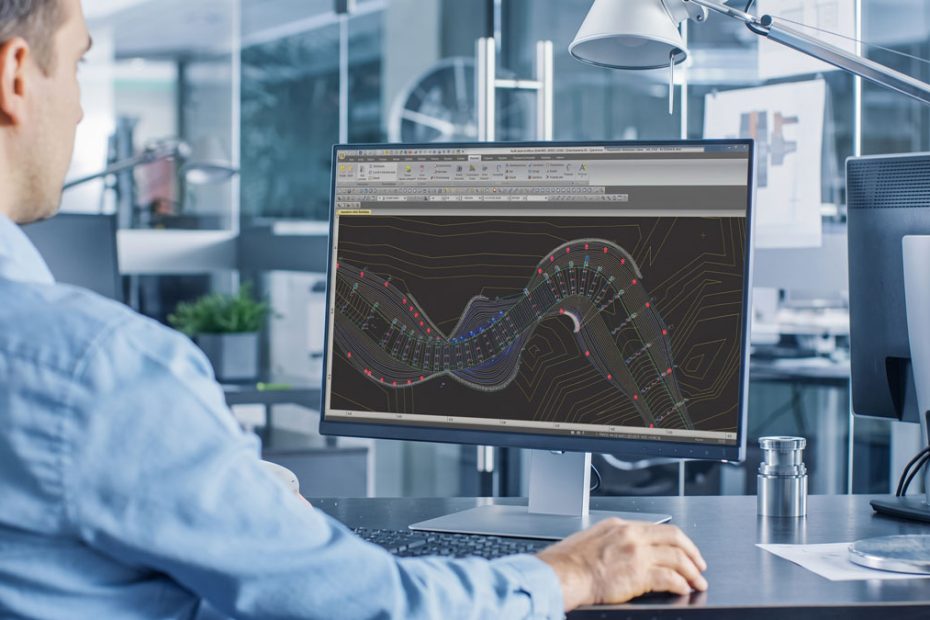
Topcon has released MAGNET Office 2026.0 and MAGNET Field 2026.0, bringing its professional surveying software back under the MAGNET name while adding AI assistance, voice commands, ArcGIS Online connectivity and new GNSS diagnostic tools.
The release also introduces a year-based version numbering system. Instead of continuing the previous Topcon Office and Topcon Field naming sequence, the software now carries the MAGNET 2026.0 designation. The wider MAGNET family includes Office, Field, Tools and Enterprise products.
The branding change may attract attention, but the more important story is the amount of workflow automation Topcon is moving directly into its desktop and field software.
MAGNET Office 2026.0 Adds AI Assistance
MAGNET Office 2026.0 introduces an integrated AI chatbot designed to provide context-aware assistance without requiring users to leave the application.
The chatbot is accessible from the Help menu and is intended to help operators find information and work through software functions more quickly. Topcon has also added a command search tool that allows users to enter the name of a routine or function and launch the relevant command directly.
That may sound like a relatively small interface improvement, but it addresses a recurring problem with mature surveying and civil engineering software. As applications accumulate more specialized tools, locating a function can become almost as important as knowing how to use it.
Another new feature is Twist Screen, which allows the project view to be rotated so north does not always remain at the top of the display. Users can reset the orientation or specify a bearing when needed.
Spell checking has also been added for text entities inside projects, including support for custom dictionaries.
CAD, BIM and Survey Data Support Expands
MAGNET Office 2026.0 includes several interoperability improvements that may ultimately have more practical value than the headline AI feature.
The software adds support for importing Revit RVT model data and Trimble FXL survey code libraries. DWG imports can now convert solids into surface information or linework, while LandXML support has been expanded for Australian cadastral workflows.
Topcon has also expanded coordinate system and geoid support, including NSRS2022 and SPCS2022 in the United States, additional Australian geoid files, Morocco Lambert zones, London Survey Grid 2025 and Norway EUREF89-related geoids.
Point cloud, DTM, corridor, takeoff and surface workflows receive a series of smaller changes and fixes, alongside improvements to layer filtering and web mapping services.
ADAC workflows have also been updated with tools for highlighting and automatically panning to selected objects, as well as additional reporting functionality.
MAGNET Field Gets Voice Commands
MAGNET Field 2026.0 receives the same AI assistant concept but adds functionality aimed specifically at survey crews working away from the office.
Voice commands allow operators to perform common actions such as storing a point, confirming a command, canceling an operation or moving to the next point without relying exclusively on touchscreen input.
Hands-free control could be particularly useful when operating a rover, pole or total station while simultaneously handling equipment or moving around a site.
Topcon has also introduced automatic offset lines. The function can generate and measure multiple lines separated by a specified offset distance, reducing repetitive setup when crews need to collect parallel features.
ArcGIS Online Connects to MAGNET Field
MAGNET Field 2026.0 adds a real-time connection to ArcGIS Online.
Surveyors can store collected points within a project while accessing background data from ArcGIS, reducing the separation between conventional field surveying and GIS data collection.
This is an important direction for field software. Surveying, mapping and asset-management workflows increasingly use the same spatial data, but they have traditionally relied on separate applications and additional import and export stages.
A direct connection gives field crews access to more of that information without rebuilding the workflow around another software platform.
GNSS Smart Functions Detect Field Conditions
One of the more technically interesting additions is a new set of GNSS smart functions.
MAGNET Field can identify conditions associated with multipath interference and tree canopy and recommend settings based on the detected environment. A Smart Dashboard also displays GNSS-related indicators including satellite status, solar activity and the K-index.
This matters because poor GNSS performance is not always caused by the receiver itself.
Buildings, vegetation, reflected satellite signals, atmospheric activity and satellite geometry can all affect positioning quality. Experienced surveyors usually recognize many of those conditions, but exposing diagnostic information directly in the field interface can make troubleshooting faster and provide less experienced operators with more context.
It also reflects a broader shift in professional GNSS equipment. Manufacturers are moving beyond receivers that simply calculate coordinates toward systems that actively interpret the positioning environment around them.
What MAGNET 2026.0 Changes
The AI chatbot will probably receive the most attention because AI is an easy feature to market. It is not, however, the most important part of this release.
The stronger changes are the ones that remove individual steps from surveying workflows.
Command search reduces time spent navigating increasingly complex software menus. Voice commands reduce interaction with the controller. Automatic offset lines remove repetitive field operations. ArcGIS Online integration reduces data transfers between surveying and GIS systems. GNSS condition detection adds another layer of intelligence between the receiver and the operator.
Together, these features suggest that Topcon is trying to make MAGNET less dependent on users memorizing software procedures.
That is a meaningful change.
Professional surveying software has traditionally been built around experienced operators who understand not only surveying principles but also the particular menu structure, terminology and workflow logic of the application they use. AI assistance and contextual automation could gradually reduce that software-specific learning burden.
There is also an important distinction between adding an AI chatbot and allowing AI to control measurement decisions. Based on the announced functionality, Topcon appears to be taking the more conservative approach. AI assists the operator, while critical surveying operations remain within established workflows.
For professional positioning software, that is probably the right balance at this stage.
About Topcon
Topcon Corporation was established in Japan on September 1, 1932, giving the company more than nine decades of experience in optical measurement, positioning and sensing technologies. Its headquarters are in Tokyo.
As of March 31, 2026, Topcon reported 4,909 employees, ¥16.984 billion in paid-in capital and ¥222.588 billion in annual consolidated sales for fiscal 2025. The group included 56 consolidated subsidiaries and 11 equity-method affiliates.
Topcon says its technology portfolio includes more than 3,450 patents. Its current businesses are centered on positioning technologies for construction, surveying and precision agriculture, alongside healthcare technologies.
The Positioning Business alone generated ¥131.36 billion in net sales in fiscal 2024. The division covers technologies including high-precision 3D measurement, machine control, construction automation and GNSS-based agricultural auto-steering.
Source: www.topconpositioning.com