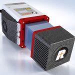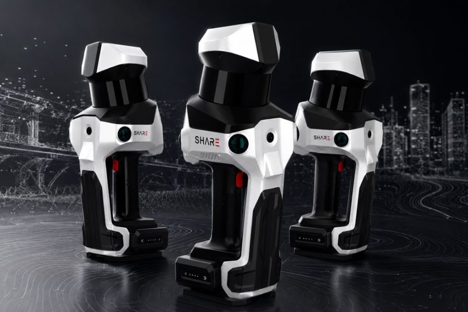
SHARE3DCAM has introduced the C10 Series, a new family of backpack-mounted mobile LiDAR scanners designed for surveying, geospatial mapping and professional reality-capture projects.
The lineup consists of three models: the C10-16, C10-32 and C10-32 PRO. Depending on the configuration, the systems offer either 16 or 32 LiDAR channels, capture rates of up to 640,000 points per second and measurement distances reaching 300 meters.
The scanners are intended for urban mapping, building facade surveys, tunnels, utility corridors, forestry, stockpile measurement, road surveys and cultural heritage documentation.
C10 LiDAR Scanner Specifications
The entry-level C10-16 uses a 16-channel mechanical spinning LiDAR sensor and records up to 320,000 points per second. The C10-32 and C10-32 PRO increase the channel count to 32 and double the maximum point rate to 640,000 points per second.
The C10-16 and C10-32 provide a maximum measurement range of 120 meters, while the flagship C10-32 PRO extends the working distance to 300 meters. This longer range is particularly relevant when scanning tall structures, large industrial sites, road corridors or building facades where operators cannot easily approach the target.
SHARE3DCAM lists relative accuracy of better than 1 centimeter, absolute accuracy of better than 5 centimeters and point-cloud thickness within 5 millimeters. Actual results will depend on movement, surface reflectivity, satellite visibility, control-point quality and the geometry of the scanned environment.
SLAM, RTK and PPK Positioning
Each C10 combines the LiDAR sensor with an inertial measurement unit, proprietary SLAM processing and a full-constellation, multi-band GNSS antenna.
The integrated RTK system is rated for horizontal positioning accuracy of 0.8 centimeter plus 1 ppm and vertical accuracy of 1.5 centimeters plus 1 ppm under suitable conditions. PPK processing is also available for projects where cellular corrections or reliable RTK reception are unavailable during data collection.
Coordinate transformation tools allow locally generated point clouds to be aligned with project coordinate systems or national survey grids. This is an important capability for engineering teams that need to combine mobile scans with control networks, existing CAD data or repeated surveys.
Mapping Cameras and 3D Models
The C10 Series uses wide-angle mapping cameras with 1-inch sensors, mechanical shutters and 16-megapixel effective resolution. Mechanical shutters can reduce motion-related image distortion compared with conventional rolling-shutter cameras, which is valuable when the operator is continuously walking during capture.
The scanners can generate colorized point clouds, while the C10-32 PRO adds panoramic stitching. Captured data can also support mesh models and 3D Gaussian Splatting, commonly known as 3DGS.
These visual products can supplement measurable point clouds in building documentation, renovation planning, digital twins, heritage preservation and client presentations.
Field Hardware and Data Export
The scanners include two hot-swappable batteries with approximately 180 minutes of combined operating time. A 1 TB SSD provides onboard storage, while Wi-Fi 6 supports 2.4 GHz and 5 GHz connections.
A visible laser can be used for control-point collection, and the backpack configuration is intended to distribute the system’s weight during extended surveys. The published device weight is approximately 2.3 to 2.4 kilograms, depending on the model.
Point clouds can be exported in LAS, PLY, PCD, E57 and RCS formats, allowing the data to move into common CAD, BIM, GIS and point-cloud processing environments.
SHARE3DCAM also plans to expand its software capabilities for stockpile calculations, automated registration of multiple scans and semantic point-cloud classification.
Technical Perspective
The most significant feature of the C10 Series is not any single specification. It is the combination of mobile SLAM capture, survey-grade positioning, large-format mapping cameras and several deliverable types within one field system.
A 300-meter range and 640,000-point-per-second rate give the C10-32 PRO credible specifications for large outdoor sites. However, range and point density alone do not determine whether a mobile scanner can produce dependable survey data. Trajectory stability, loop closure, control-point integration, camera calibration and processing consistency will ultimately be more important.
The inclusion of RTK, PPK and coordinate transformation suggests that SHARE3DCAM is positioning the C10 above visualization-focused handheld scanners and closer to professional geospatial workflows. Its real competitiveness will depend on how reliably the software preserves accuracy across long routes, GNSS-denied spaces and transitions between indoor and outdoor environments.
About SHARE3DCAM
SHARE3DCAM Limited is headquartered in Shenzhen, China, and says it has spent more than a decade developing technology for capturing and reconstructing real-world spaces. Its portfolio covers three principal equipment categories: S Series renovation scanners, C Series geospatial scanners and aerial survey cameras.
The company also develops SHARE Capture for field operation and SHARE PointClouds Studio for point-cloud processing, measurement, CAD preparation and 3DGS model generation. Both applications are offered free of charge to SHARE3DCAM hardware users.