Norwegian war-risk insurer DNK has introduced a new assured positioning, navigation and timing program for vessels exposed to GNSS jamming and spoofing, marking a notable shift in how maritime insurers are responding to electronic interference in conflict-prone sea lanes.
The program gives DNK members access to A-PNT systems from selected technology vendors using Iridium’s low-Earth orbit satellite network. Participating shipowners may also qualify for insurance premium rebates when they install approved systems designed to improve navigation resilience during GNSS disruption.
Maritime GNSS Risk
GNSS interference is no longer a narrow technical problem for bridge electronics. For commercial vessels, degraded or manipulated satellite positioning can affect route planning, collision avoidance, timing-dependent onboard systems, sanctions compliance and operational decision-making in restricted waters.
The problem has become especially visible in areas such as the Black Sea, Baltic Sea, Persian Gulf and Red Sea, where geopolitical tension has increased the use of jamming and spoofing against civilian navigation signals.
For shipowners, the risk is practical: a vessel may still be physically seaworthy while its digital awareness is compromised. That is exactly the type of risk insurers are now being forced to price more seriously.
Iridium PNT Backup
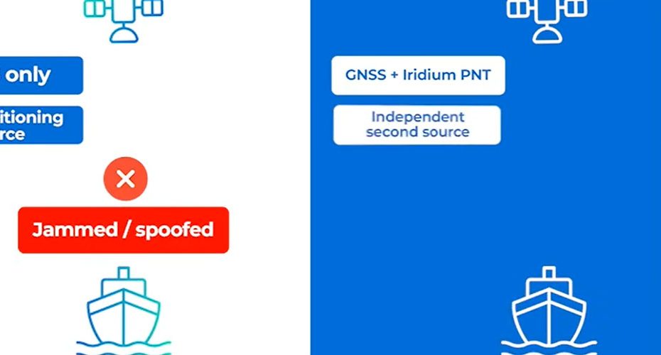
DNK’s program is built around Iridium’s LEO satellite infrastructure, which provides an alternative signal source when conventional GNSS signals are degraded, jammed or spoofed. The Iridium constellation uses 66 operational satellites in low Earth orbit, supported by in-orbit spares, and is designed for global coverage including oceans and polar regions.
The key technical advantage is signal resilience. Iridium’s LEO signal is far stronger at the receiver than traditional GNSS signals from medium Earth orbit, making it more difficult to disrupt with the same low-cost jamming techniques used against GPS, Galileo, GLONASS or BeiDou.
That does not make Iridium a replacement for GNSS in every maritime application. Instead, its value is as an independent “source of truth” that can help crews and operators detect when GNSS data is no longer trustworthy.
Shipboard System Design
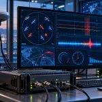
The approved systems are expected to use above-deck equipment to receive the Iridium-based PNT signal and monitor jamming or spoofing activity. DNK also describes an optional below-deck unit that can provide real-time situational awareness to the crew.
This architecture matters because the system is not only about keeping a position fix alive. It also creates a feedback loop between the vessel and the insurer. Telemetry about interference events can help DNK build a clearer operational risk picture across different regions and routes.
From an insurance standpoint, that data may become just as valuable as the hardware itself. A fleet-wide interference map could help underwriters separate temporary local disruption from sustained hostile activity in high-risk corridors.
Insurance Meets A-PNT
The most important part of DNK’s move is not simply the use of Iridium. The more important signal is that A-PNT is being tied directly to insurance pricing.
Premium rebates create a financial reason for shipowners to install resilient navigation systems before an incident occurs. That could push A-PNT from a specialist security upgrade into a more normal risk-control measure for vessels operating near conflict zones.
This is a meaningful change. Maritime safety has traditionally treated GNSS interference as a navigation problem. DNK is treating it as an insurable operational risk with measurable mitigation.
Technical Analysis
DNK’s program looks like an early example of where maritime resilience is heading. In the past, many operators treated GNSS jamming as a temporary nuisance, something crews could work around with radar, visual navigation and manual procedures. That view is becoming outdated.
Modern ships rely on positioning and timing data across multiple digital systems. When that data is manipulated, the issue is not only where the vessel appears on a chart. The larger problem is trust in the whole information chain.
The smart part of DNK’s approach is that it does not promise a single miracle solution. Instead, it adds an independent PNT layer, connects that layer to operational awareness, and links adoption to insurance incentives. That is a more realistic model than expecting maritime operators to abandon GNSS or replace all existing systems.
The bigger market implication is clear: A-PNT could become a standard requirement for vessels trading in high-risk regions, much like cyber controls and anti-piracy measures became part of modern maritime risk management.
About DNK And Iridium
DNK, formally Den Norske Krigsforsikring for Skib, is a Norwegian mutual war-risk insurance association headquartered in Oslo. The organization was founded in 1935 and provides war-risk cover for Norwegian maritime assets, including risks linked to war, terror, piracy and cyber incidents. Publicly available background information describes DNK as covering approximately 3,500 Norwegian ships and drilling rigs, making it one of the world’s largest mutual war-risk insurers.
Iridium Communications is a US-based satellite communications company headquartered in McLean, Virginia. Its network is built around a low-Earth orbit satellite constellation with 66 active satellites and in-orbit spares, supporting global voice, data, safety, defense, aviation, maritime and PNT-related services. Iridium has also been expanding its positioning, navigation and timing portfolio, including work on compact PNT technology planned for commercial availability in 2026.